The other day
As usual, Higashinihombashi was walking in the direction of Bakurocho. The future is Chiyoda-ku, so what is the border between the ward?
I decided to walk along the ward world.
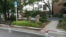
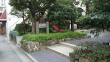
Then there was an interesting discovery. The area around Kandaiwamotocho, Otemmacho, and Kodemmacho is complicated, and one park is Chuo-ku and Chiyoda-ku.
There was a park with a signboard.
It is "Ryukan Children's Park". There is no clear border in the park, and a small bridge is the border between Chiyoda-ku and Chuo-ku.
It is a small park with a Japanese-style public toilet.