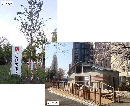
"Tsukiji Lion Festival" at Namiki Shrine in Tsukiji. This year is the main festival once every three years, and on June 8, the Funa imperial procession, which was held during the Edo period, will be restored. After going out from Tsukiji Market to the Sumida River for a water festival, proceed along the Tsukiji River, which runs between Hamarikyu and Tsukiji Markets, and imperial procession to Ote-mon gate Bridge in Hamarikyu.
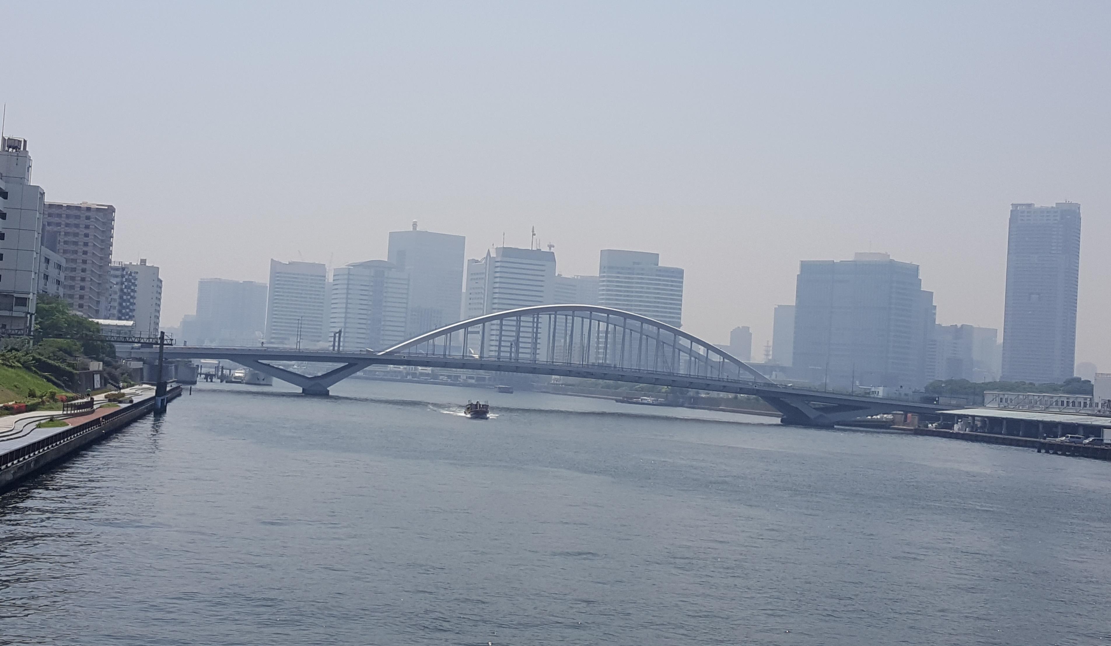
A free observation space on the 46th floor of Carletta Shiodome, right above the Ote-mon gate Bridge. I could see Hamarikyu on the right, Tsukiji Market on the left, Sumida River on the top, and Tsukiji River on the middle, portable shrine on the imperial procession.
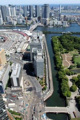
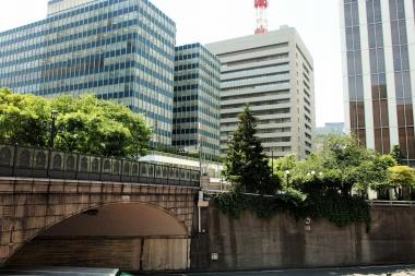
I came down from the 46th floor to the Ote-mon gate Bridge in Hamarikyu. This bridge, which straddles the Tsukiji River, is also called "Nanmon Bridge". In the past, the Tsukiji River and the Shiodome River flowed in the form of contact, but the upstream of each river has been reclaimed. It is only around Hamarikyu that is pouring water, so it is a valuable place where the remnants of the past remain.
What kind of landscape was spreading in landfilled and now the highway is running? Let's walk a little along the old river and think about the scenery that used to be near the waterside.
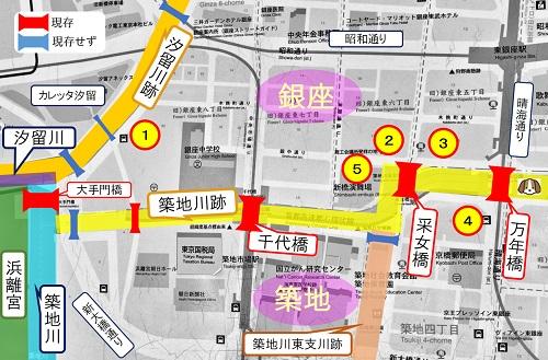
[Along the old Shiodome River]
The area where old railroad crossing traffic lights are left (1). The name of the town here is Ginza, but in the past it was called Kiboricho. At present, this place where the Ginza Post Office is located was a large Renaissance-style building of the Ministry of Communications from the Meiji era to the Taisho era.
It seemed to be facing the Shiodome River and facing the direction of Shimbashi, and there was also a telecommunications museum in the building. Unfortunately, it was burned down in the Great Kanto Earthquake, but in this era there was a waterside landscape that could not be imagined along the current murderous highway.
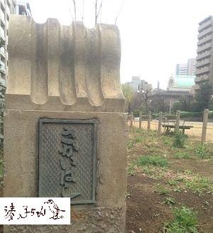
Sendai Bridge on the Tsukiji River.
It seems to be a bridge that was not in the Meiji Taisho era, and was built as a reconstruction bridge after the Great Kanto Earthquake. In the Edo period, a bridge called "Sendaibashi" was built around here, so it must have been named after that name.
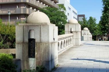
The shape was a bridge called a "reconstruction station-type bridge" created by the Reconstruction Bureau, and was a type of bridge that was built on several nearby rivers. Among them, this Sendai Bridge may have been particularly beautiful, and it can be felt by looking at the remaining main pillars and railings. In fact, it seems like that.
Unfortunately, there is a park space on both sides of the bridge, which makes it impossible to see the exterior of the former Sendai Bridge.
I would like to think again about why this bridge was built especially beautifully.
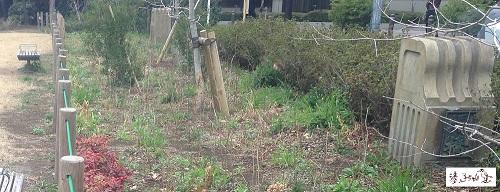
Around the Tsukiji River Remains and Mannen Bridge
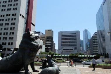
A statue of the famous dog Tiroli in Tsukiji River Ginza Park near Mannen Bridge. There were many picturesque architectural landscapes in the direction of "Mannen Bridge" and "Uneme Bridge" where Tyroli is facing. It was said that it was located between the foreign settlement in Tsukiji and the brick street in Ginza, so a mixture of Japanese and Western styles was formed. I would like to take a look at it.
Before the Great Kanto Earthquake of the Great Kanto Earthquake
From the Tsukiji side, take a look at the Ginza (Kiboricho) side over the Saijo Bridge. The building on the left is the Ginza 6-chome Square Building, which used to be home to Nissan Motor's headquarters. On the right side of Miyuki Street is the Jiji Communication Building (3), which used to be the Ginza Tokyu Hotel building.
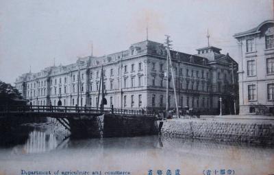
 During the Taisho era, the large government building of the Ministry of Agriculture and Commerce (2) was lined up here, and the Tsukiji Seiyoken was lined up to the right (3), and along the Tsukiji River, it looked like a Taisho era romance.
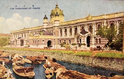
"Ministry of Agriculture and Commerce" is a Western architecture called the French classic style, and was designed by Takamasa Shinie in 1891 (Meiji 24). It is said that there was also a product display station where samples were displayed for the purpose of encouraging agriculture, industry and commerce, and played a role as a place for breeding industry policies and public-private cooperation.
On the other hand, the place where the next Tsukiji Seiyoken was built was called "Samemachi" at that time. Seiyoken has a long history and opened in 1872 (Meiji 5) at Baba Sanmon in front of the Imperial Palace. However, on the day of the opening, he was burned down by "Ginza Fire", so he moved to Kibiki-cho. The following year, he built a new building in this area of the neighboring town of Saimen, and started full-scale operation of hotels and restaurants.
Tsukiji Seiyoken contributed greatly to Civilization and enlightenment in the early Meiji era as a restaurant serving authentic Western cuisine. Considering that it led to the spread of Western cuisine after that, its historical significance was significant.
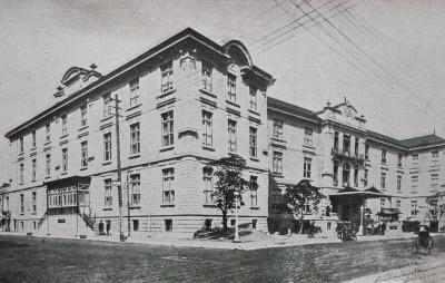 The building was rebuilt in 1909 (Meiji 42), designed by Jan Lettzel in the Czech Republic, and made the Tsukiji River gorgeous. He is also known as the designer of the Hiroshima Prefectural Product Exhibition Hall, which became the Hiroshima Peace Memorial Museum.
Unfortunately, along with the neighboring Ministry of Agriculture and Commerce, it was destined to be burned down by the Great Kanto Earthquake.
After the Great Kanto Earthquake of Mannen Bridge
Around the Mannen Bridge, the Tokyo Theater opened in 1930 (Showa 5) after the earthquake. It is said that the heavy figure was also proud of this area (4).
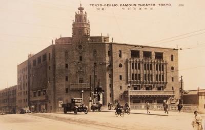
Since the nearby Kabukiza was destroyed by fire in the Pacific War, there were times when the East Theater, which survived the disaster, became the center of Kabuki after the war, but it was rebuilt into the current building in 1975 (Showa 50). I have.
"After the Great Kanto Earthquake of the Great Kanto Earthquake"
After the earthquake, Shimbashi Enbujo in Kibiki-cho was completed in 1925 (Daisho 14) next to Saijobashi (5).
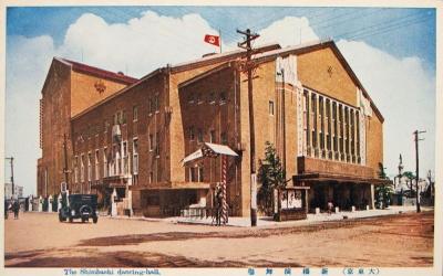 Construction started before the earthquake, but the completion was extended due to the effects of the earthquake. It is said that this place was where the Tsukiji River was refracted in a crank shape, and before it was built, dense trees were growing. It is said that the moss was the first "go east."
Designed by Eizo Sugawara, also known as the designer of Ginza Lion. On the outer wall, there was a terracotta decoration (decorative decoration) that was popular during the reconstruction period of the earthquake, which was one of the features of this building.
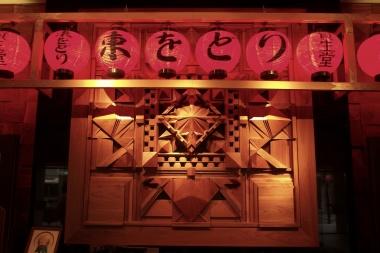
It was rebuilt in the current building in 1982 (Showa 57). When you enter the lobby from the front entrance, you will be greeted by a square wooden decorative wall. This is made by copying the pattern of terracotta. Late May is the season of "East Odori" every year, and this year marks the 94th anniversary.
In this way, along the Shiodome River and the Tsukiji River, there was a waterside landscape with architecture that people at the time wanted to make postcards. However, it is really disappointing that we have no choice but to imagine that landscape now.
Now, the Metropolitan Expressway runs on the Tsukiji River as if sewing the bottom of the former river, but there is a plan to cover it and make it a large park. If you cover it, you may lose some of the remaining waterside features.
However, I would like to think positively that it would be a good thing if we could leave a better landscape for future generations than now.


 ▲There were two main pillars: "Sakaihashi" and "Sakae Bridge" (foreground).
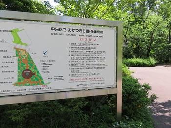
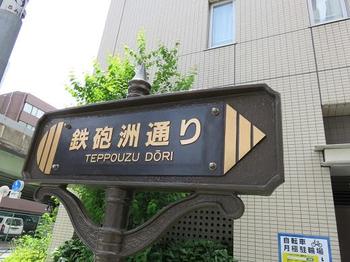
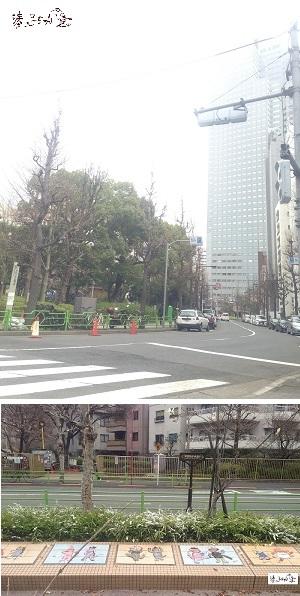 In Akashibori, the current Akatsuki Park area is the former one. It was shaped like a triangle, with "Shinminato Bridge" at the entrance to the Tepposu River and "Sakae Bridge" at the entrance from the Tsukiji River.