I walked around Ginza using the recently released sightseeing map application "Tokyo Chuo-ku Town Walking Map". Even if you don't have a guidebook or a large map, you can use a smartphone or tablet terminal to get information at hand and expand the scope of use.
 The area is Ginza. According to the map of Mie Takahashi's fun illustration, tap the icon of the camera mark where you want to see the photo and commentary will appear (the photo is the screen of the Ginza 4-chome intersection). It is marked with a lot of history, sightseeing, shopping and gourmet spots. There is also a kind comment on the map "Matsuzakaya" that "it will be reopened in 2017 for redevelopment."
This time, when you touch the 'old map', it switches to Edo-kiri picture. Since it is the 7th edition of Owariya Seishichi edition of 1849 (1849), the color is good and easy to see. If you choose a normal map (standard map), you can also check the current location with location information.
If you choose the "Recommended Route" menu, "Hanagata" Ginza dance with instrumental accompaniment dance with instrumental accompaniment (Burabura) course", "Luxury" Ginza store visit (Tekuteku) course", "Good luck in Ginza! There are three kinds of courses of Hatcho-jinja Shrine Tour. When you touch the course you want to walk, the route will be displayed with the arrow from the start mark, and it will tell you to the goal. If you try various things, it will be interesting to walk around Chuo-ku town.
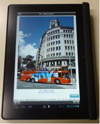
This time, I used an Android OS tablet terminal, which was connected with G-FREE, a Ginza free Wi-Fi that was expanded to Harumi-dori St.. Akira Makibuchi
◇For more information about this app, visit the Tourism Association website >>Please see here. In addition, TV public information of Chuo-ku HP "Honichi is Chuo-ku" No.293 (broadcast from January 12-17, Heisei 26) >>It is also introduced here.

