Today (October 27, 2015) departs from Kayaba Bridge. (All photos taken on October 27, 2015)
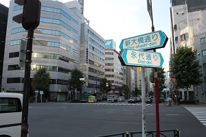
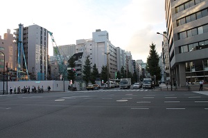
A short walk from Kayaba Bridge, the intersection with Eitai-dori St. You can also see "COREDO Nihonbashi" on the right.
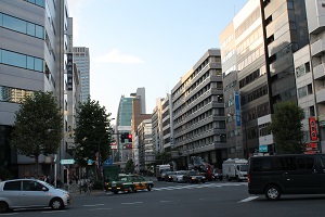
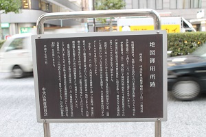
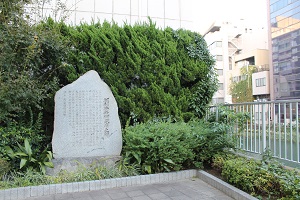
As you go further on Shin-ohashi-dori St., you will also find an explanation version of "Map Goyosho Ruins" on the left walking path (near 2-12 Nihonbashi Kayabacho).
The "Map Goyosho" was located in the residence of Tadataka Ino (1745-1818), known for producing the first full map of Japan based on actual measurements.
Tadataka Ino began surveying all over Japan in 1800 (1800), surveying the coasts of Japan for the next 17 years, and it is said that the total distance was about 40,000 km.
In 1814 (1814), Tadataka returned from surveying in the Kyushu region and moved to the vicinity of the current location, which was called Hatchobori Kamejima-cho. The site of this mansion was about 150 tsubo, but it was used not only as a place of residence for loyalty but also as a map gosho for creating survey maps.
Tadataka died in his home in Kamejima-cho in 1818 (1818) before the map was completed, but Tadataka's home was still used as a map gosho, and in 1821 (1821) The "Dainihonenkai Yochizenzu" was completed by the hands of the masters.
Continue further to the intersection with Yaesu Street.
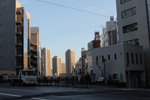
On the left side of this intersection is Kameshima Bridge, where there is also the "Horibe Yasubei Takeyuki Monument" (Monoshiri Encyclopedia; page 55). Under Kameshima Bridge, the Kamejima River still remains, and it is one of the few active bridges that were replaced in 2002 (Monoshiri Encyclopedia; page 56). High-rise apartments in River City 21 can also be seen from a distance.
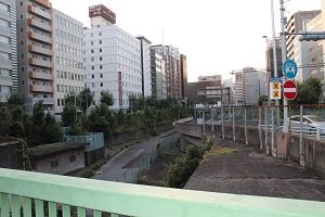
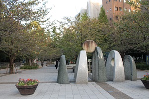
If you follow Shin-ohashi-dori St., you will see the entrance to Sakuragawa Park on the left. Horiwari, which was called Hatchobori in the Edo period, was renamed Sakuragawa in the Meiji era. Sakuragawa Park was created using a part of the site that was reclaimed in the middle of the Showa era.
 From Irifune Bridge, when you look at Chuo-ku government office, Ginza Blossom, etc., it is clear that below was a river.