If you look downstream from Kamakura Bridge over the Nihonbashi River, you can see a sluice gate on the left bank.
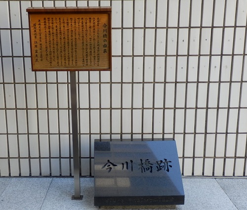
This is the trace of Kawaguchi, where the former Ryuka River flows into the Nihonbashi River.

However, the Ryuka River was the Horikawa River, which was excavated by townspeople at their own expense as a fire protection zone after the great fire of the Meiryaku era (1657), until it was reclaimed in 1950 for post-war waste disposal .
Hongo, Koishikawa, and Kojimachi are said to be the source of the great fire in the Meiryaku era, but the fire momentum from Koishikawa burns the densely populated towns such as Nihonbashi, and the dead are said to be more than a quarter of the population of Edo. It is said that more than 100,000.
When Kanda became the source of fire, it was prone to a large fire due to the dry northwest wind in winter, and in fact, Kandasakumacho was a place where the fire was so large that it was called "Akuma-cho". It must have been inevitable that the river was dug.
The digging for fire prevention has been the boundary between Kanda Ward and Nihonbashi Ward since 1878, and has been the boundary between Chiyoda-ku and Chuo-ku even after being reclaimed after the war.
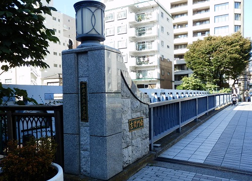
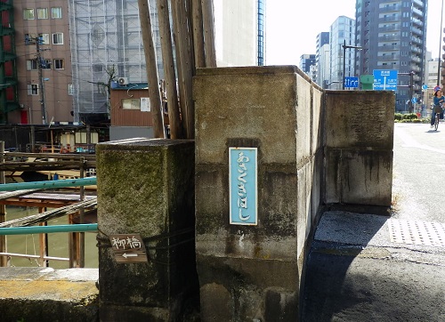
The surface of the sluice gate is a facility of the Waterworks Bureau, and the balustrade of the former Ryukan Bridge is preserved across Sotobori-dori St.
Yes. This bridge was replaced in 1926 (1926) and is the first reinforced concrete truss bridge in Japan.

The name of Ryukanbashi and the river was derived from the fact that there was a house of Ryuka Inoue, a tea priest of the Shogunate, in a town on the west side of this river.
The alley just behind the railing of Ryukanbashi was the Ryukangawa (moor), and this alley is still the ward of Chiyoda-ku and Chuo-ku.
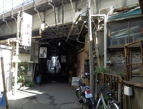
Follow this alley for several hundred meters and pass through the guard of the JR Line. Above is the viaducts of the Taisho era, Showa and Heisei, as well as the Tohoku and Joetsu Shinkansen lines.
Located on the south side of Kanda Station, under the guard called Imagawa Koji, there are more than a dozen bars.
It is Imagawa Bridge where this alley, Ryukagawa River ruins intersect with Chuo-dori. (It is slightly different from the Imagawa Bridge intersection.)
Near this bridge, they sold baked confectionery made by putting flour dissolved in water in a mold. In other words, Imagawa Bridge is the birthplace of Imagawa-yaki.
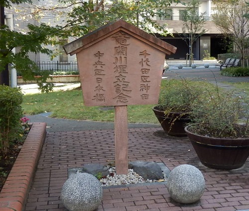
After crossing Chuo-dori, there is a small park in front of Showa-dori, and there is a monument buried in the Ryukagawa River. Showa-dori has to cross the pedestrian crossing bridge, but the alleys continue.

After crossing Ningyocho Street, you will find a park after Kodemmacho, and the ruins of the former Ryukagawa River end here.
This park, like the ward of Chiyoda-ku and Chuo-ku, has a different name from "Ryukan Children's Amusement Park" on the Chuo-ku side, and "Ryukan Children's Park" on the Chiyoda-ku side (laughs).


The alley continues from behind this park, but it is not the trace of the Ryuka River, but is the evidence? Both sides of the road are Higashi-Kamida, Chiyoda-ku. The road on the southeast side of this alley (a relatively wide one-way road) becomes the ward boundary. The Chuo-ku side is Bakurocho 1-chome.

Eventually, I went to Yasukuni Dori and thought that Watari Saemonbashi-dori was the ward, and for some reason, Chuo-ku was to the west side of one block.

The Kanda River's Saemon Bridge, Asakusabashi, and Yanagibashi become the ward border with Taito Ward, go out to the Sumida River, become the ward border with Sumida-ku at Ryogokubashi, and the walk around the ward ends. It was a small one hour walk.


After that, from the downstream of the Sumida River, the Harumi Canal and Tokyo Bay will form a ward border with Koto-ku.

