Hello. This is a new correspondent, Hanes.![]()
![]()
This time, it is an excursion series that allows you to know the history of the ward outside Chuo-ku, following the previous time.
The second stage is Glover Garden in Nagasaki City.
Here are some of the things related to Chuo-ku that I met unexpectedly.
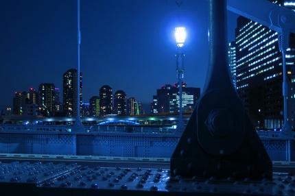
As soon as possible, what is related to the focus this time?...Here!
The answer is shown in the photo, but it is called "autonomous phone".![]()
Unlike modern telephone boxes, it's stylish and Western style.![]()
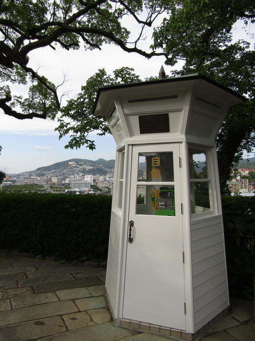
For a moment, I thought, "Isn't it a scene unique to Nagasaki where the influence of the West remains strong?"
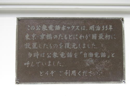
If you look closely,
"We restored the first one in Japan under Kyobashi, Tokyo in 1900."
Isn't it written?![]()
When I was worried and looked for the photos at that time, there was something!
A quaint automatic telephone box located in Kyobashi, where there is no skyscraper yet.![]()
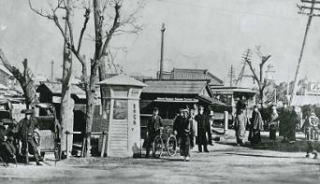
(Includes Communications Museum)
At that time, telephones translated directly from the name "Automatic Telephone" used in the United States.
It was named "autonomous phone", but it is the same as a public phone.
1 When the city call charge (15 yen) at the time of a call was reduced to 5 yen two years later, the number of users increased and spread!
By the way, it began to spread in 1902. Shiseido Parlour is open in Chuo-ku.![]()
At that time, the hairdressing fee was 5 yen, the same as the call fee for one call, while the parlor ice cream soda was 25 yen per cup.
You can reconfirm that it was a very expensive drink.![]()
Now, let's go back and look back on the history of public telephones here.![]()
------------------------------------------------------------------------------------------------------------------------
Until September 1900, there were public telephones that were only available in the telephone branch offices and post offices at Ueno and Shimbashi stations.
It will be installed on the premises.
An outdoor public telephone booth at the beginning of October 1990 will be installed at the base of Kyobashi.
(For details after that, please see NTT West Japan "Transfer of Public Phones.")
-----------------------------------------------------------------------------------------------------------------------
The fact that Japan's first permanent escalator was installed in the new building of Mitsukoshi Nihonbashi.
I learned from studying the Chuo-ku Tourism Test, but
It was here in Chuo-ku that a public telephone entered the street for the first time.![]()
Although it is a restoration, try to enter the automatic telephone box in commemoration.
If you pull this handle that fits into the box, you will find it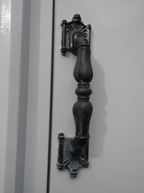
The interior was as large as the modern one.
As it is not transparent from top to bottom like modern ones, visibility is somewhat limited, but
I was able to enjoy the mood of a caller from a newly introduced automatic phone.![]()
I sent you a series of excursions through two articles with Hiroshima City and Nagasaki City.
There must be a lot of charm and related history of Chuo-ku that can be found outside the city.
It's quite fun to look for historical sites related to Chuo-ku on the go.![]()
Chuo-ku Tourism Association Official Blog
Chuo-ku Tourism Association correspondent blog
Introducing Chuo-ku's seasonal information by sightseeing volunteer members who passed the Chuo-ku Tourism Association's Chuo-ku Tourism Certification and registered as correspondents.
List of AuthorsRecent blog post
|
[Second Excursion Series] It was in Kyobashi! Japan's first street payphone
Chuo-ku, where the times pass.
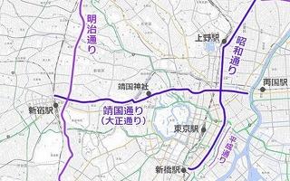
If you drive in Tokyo, you will find the Meiji Dori, Showa-dori, and Edo-dori St.
In the past, Toden was running around here, so it was also called "Train Street".
By the way, "Taisho-dori", the current "Yasukuni Dori" is "Taisho-dori" until before the war. In that sense, Meiji-dori St. does not go to Chuo-ku, but there is no such thing.
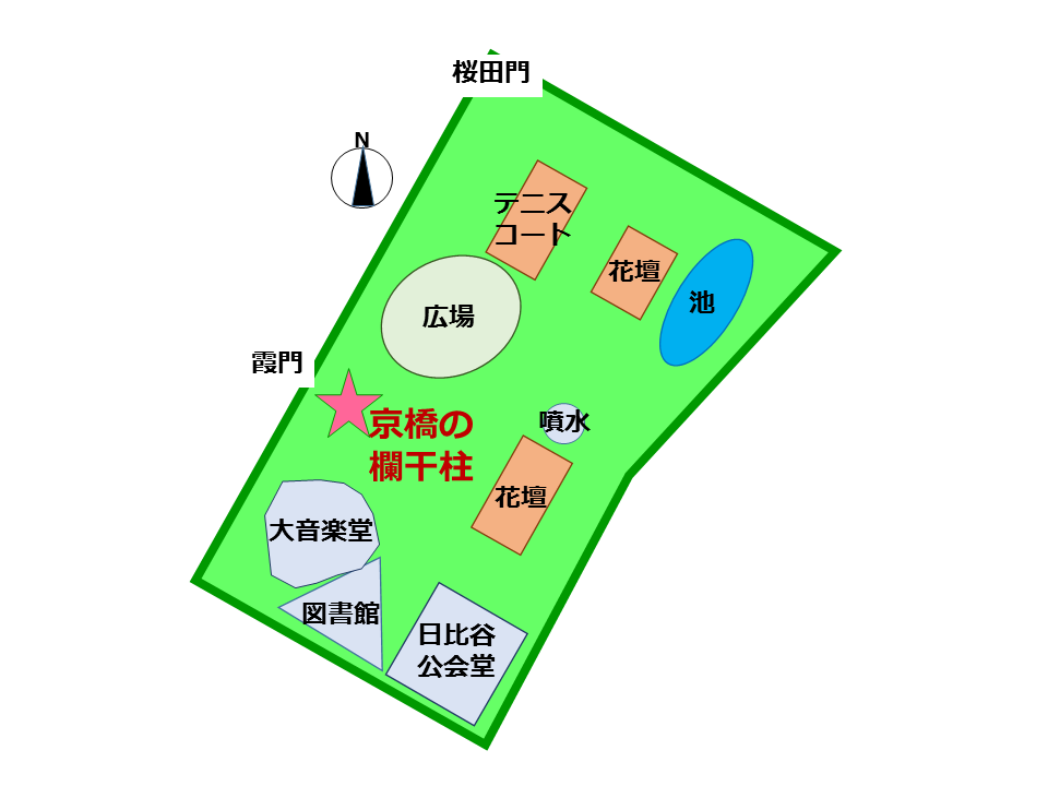
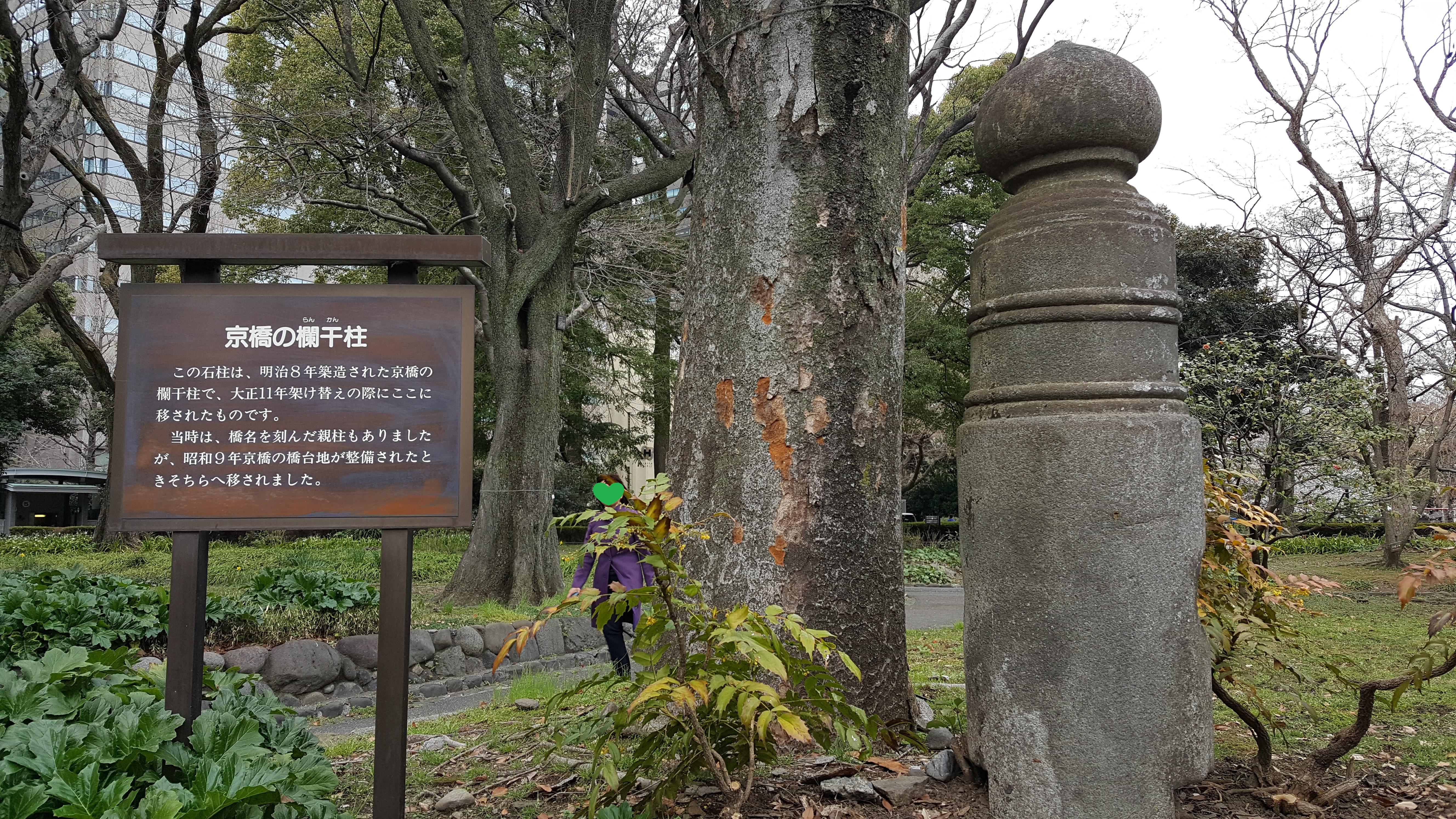
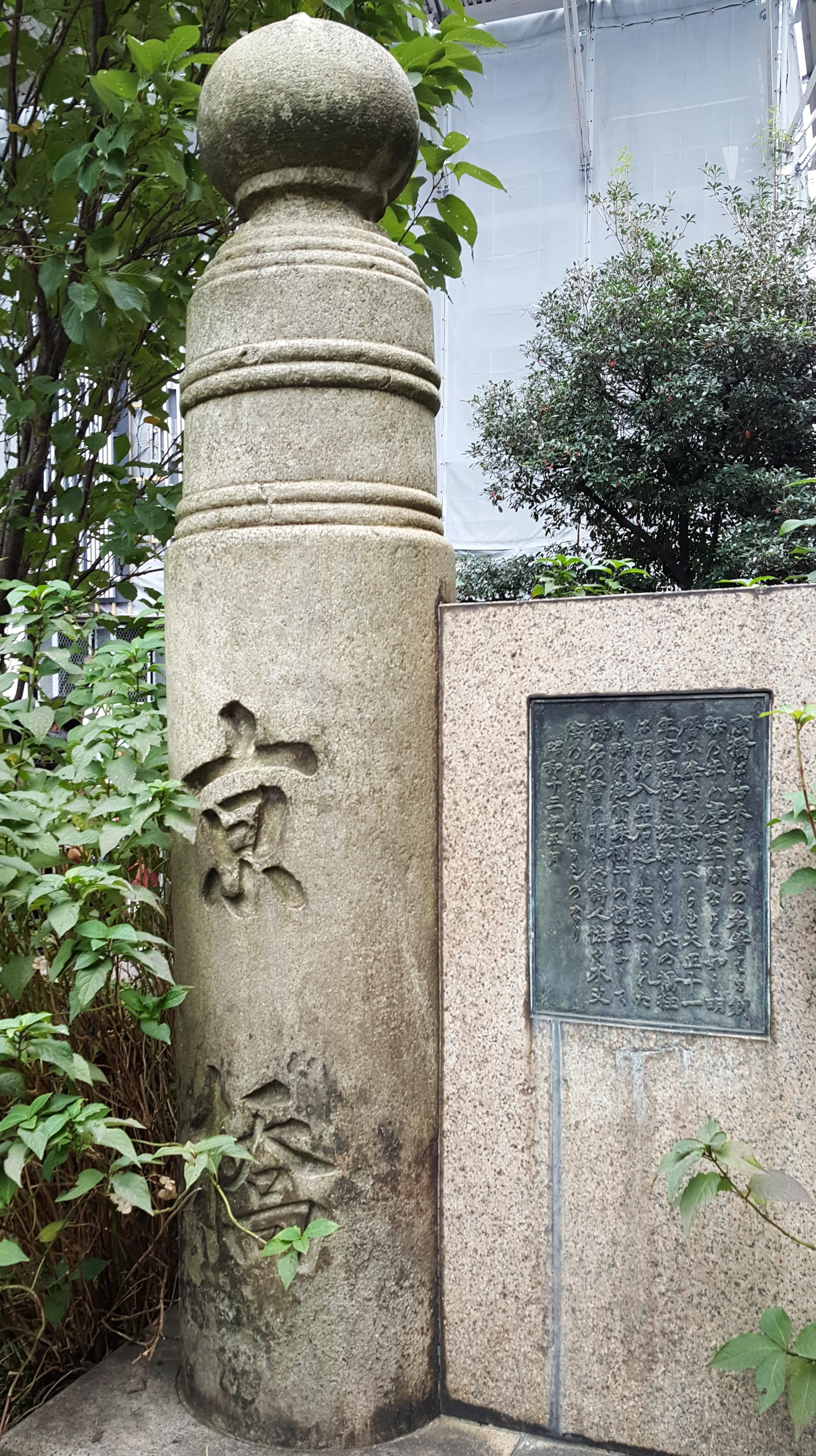
"Kyobashi" in Hibiya
(Upper figure: balustrade of Hibiya Park Below figure: main pillar near Kyobashi)
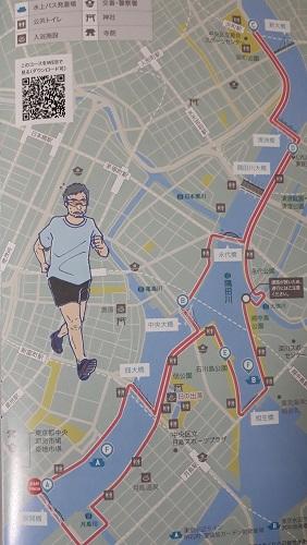
After the Tokyo Marathon
The Tokyo Marathon, which is worthy of being called the Marathon Festival, has been successfully completed.
(The newspaper advertisement after the Tokyo Marathon is aimed at runners with the motif of Packman. Tourist correspondents cannot overlook "Nihonbashi" shining in the middle. )
I think it is also very good to take new measures such as collecting clothes that runners wore to keep them warm in boxes along the road and turning them into recycling
This time, I ran for the 2-hour range (less than 3 hours in a full marathon is called a sub-three). This will continue to run at a speed of 14.1 km / h, 4 minutes / 13 seconds.
It's going down for a while from the first gun. Theory says, "If you fly too much here, you will come to your feet later, so keep your eyes suppressed," but even if you fly, nothing is crowded and it is difficult to proceed. Perhaps the position of the line was too behind, the pace around me was slow, and even if I pulled it out considerably, it took about 1 km 4 minutes 50 seconds. "... it's hard to rewind this delay." A weak sound looks as soon as possible
I returned to about 1 km 4 minutes 14 seconds from the middle, but I can't get back the first delay if it is. However, considering the second half, it is dangerous to fly any more. The legs continue to be heavy. I want to respond to the support of the roadside, but I don't have much time to do it.
From the time it exceeds 30 km, more and more runners are clearly slower. I pull it out little by little, but I myself begin to cram my left calf and my left toe. Driving while searching for a position to see how your feet do not cramp.
I was about 10 minutes behind my goal, but when I was given a medal to a volunteer at the goal, "Congratulations!", I was somewhat moved and tears came out. Because there is this, it may be that I will enter again. (Thank you very much to all the volunteers.)
Well, the Tokyo Marathon is also a great place to appeal for tourism. Some of the brochures we received are full of highlights. Just following the contents of these brochures may take about a year.
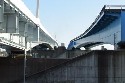
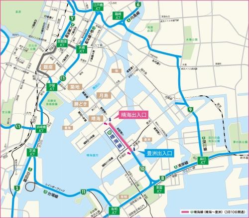
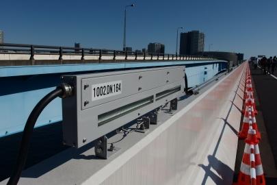
◆ The future seen from the Metropolitan Expressway Harumi Line
The route between Toyosu and Harumi on the Metropolitan Expressway and Harumi Line will open on March 10 (Saturday). The other day, there was a walking event called "Harumi Line Skywalk" commemorating it, hosted by the Metropolitan Expressway, and I walked on the expressway before opening.
The Metropolitan Expressway No. 10 Harumi Line. This road is a highway that branches off from Wangansen, and about nine years ago, the Shinonome Junction in Wangansen to Toyosu Entrance in Koto-ku was opened. With this opening, the road to Toyosu will be further extended, crossing the Harumi Canal, leading to Harumi Wharf in Chuo-ku.
(From the Tokyo Metropolitan Expressway website)
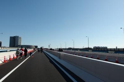
On the Metropolitan Expressway, walking events are often held just before opening a new road. Once opened, you will not be able to walk, so I often participate in this event where you can experience valuable things.
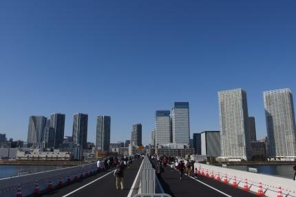
From the new Harumi entrance, go out on a new road where the sun shines, and it is finally the start of a 1.8km round trip.
You go up the straight one-way, one-lane road, but on a very gentle uphill, you can walk slowly. Above all, there was a sense of liberation, and I had a feeling that I could walk very comfortably.
As it is, we will cross the canal gently up toward Toyosu.
One reason why there is a sense of liberation is that tall streetlights are not made. The streetlights installed at intervals of several meters will illuminate the road from a low position.
As I proceeded, I gradually saw buildings in the direction of LaLaport in Toyosu, Koto-ku, on the left side of the bridge. It is a city that has been developed in recent years, but it feels like a very well-organized cityscape in terms of landscape.
Looking back a little, there was a retro bridge and a houseboat. If you look closely in the modern landscape, you can see that such a year-old landscape is embedded.
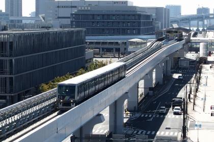
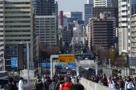
I climbed a straight road, crossed the canal, and reached the sky above the Yurikamome line running over the overpass. The Metropolitan Taka Harumi Line has to overcome the elevated Yurikamome elevated road, so it is an even higher elevated road.
This "Yurikamome" is very popular with foreign tourists. It seems that this unmanned vehicle, which runs through modern buildings, overlaps with the vehicles of the future city that I have envisioned in my head.
By the way, the sky above Yurikamome is the turning point of today's walking.
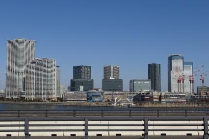
Here, look back on the road that has just come and look at Harumi, Chuo-ku from a high place. Then a pleasant landscape spread out in front of me.
This landscape is probably meaningful.
The Tokyo Olympics will begin two years later.
There is an athlete village at Harumi Wharf, and there are many competitions in this area. At that time, not only players, but also media from various countries and many tourists gathered in this Gulf region, and the city of the future city called "TOKYO" will be transmitted to the whole world.
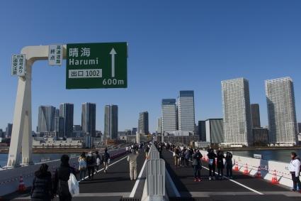
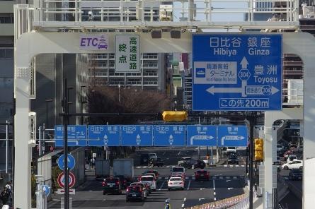
You will probably use Wangansen to get from Haneda Airport or Narita Airport to Harumi's Athlete Village. Turn around the Shinonome Junction, climb up a gentle slope, and after Yurikamome, you can see your destination from a high place.
"A little more" to the athlete village. The future city of Harumi, Chuo-ku spreads out in front of you.
Tokyo welcomes people all over the world with this landscape of Harumi, Chuo-ku.
I think it's quite good, but I'm looking forward to seeing how foreign visitors can feel the city of "TOKYO" when they go down this slope.
Freeway to Chuo-ku. You can see the sky tree on the right. The left is the Rainbow Bridge.
This road is a downhill like a runway that is as competitive as the scene of Yumin's song.
After landing, turn left and right.
If you go straight, you will find the Japanese technology Kachidokibashi, Asian Tsukiji, the cultural architecture of Kabukiza, the luxury city of Ginza 4-chome. And it leads to the middle of Tokyo.
The future of Tokyo, which will be built more and more in the neighborhood, including this road.
The Metropolitan Expressway Harumi Line is a road that will lead to Tokyo in the future.
Two years before the Tokyo Olympics. I hope that it will be a wonderful future city that will be ready without delay and will be praised by the world.
◆ Reviving memories of Kiyosu Bridge in Sumida River
Cold weather continues this year. There were several snows in Tokyo. The snow on January 22 was reported to be the first heavy snowfall in four years, and on TV, Tokyo people who were unfamiliar with snow and cars standing up were projected.
I remember that the heavy snowfall four years ago was also very difficult. At that time, I'm taking a cold picture.
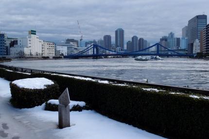
February 15, 2014. This day is the day of the 6th Chuo-ku Tourism Certification. After finishing my first test, I wanted to see the snow scenery of Kiyosu Bridge over the Sumida River from a distance, and walked on the Sumida River Terrace in Koto-ku, opposite Chuo-ku.
If you look at this picture, a certain event will come back to my head.
The other day, I walked along the Sumida River, following the memories of four years ago.
The snow continued from Valentine's Day the day before to midnight. On the morning of the test day, I was worried about the amount of snow I had accumulated, but I wanted to see the snow scenery of the Sumida River that I couldn't see much. .
The test site is the Royal Park Hotel in front of Suitengu, Chuo-ku. At that time, I lived in Koto-ku, so I decided to stop going by subway, walk across the Sumida River, and head to the venue.
There are a number of bridges that can be walked from Koto-ku to Chuo-ku, but the bridge that looks like snow is Kiyosu Bridge. Kiyosu Bridge was built during the reconstruction of the Great Kanto Earthquake. While the Eitai Bridge on the same Sumida River is said to be masculine, Kiyosu Bridge is considered feminine because of its elegance, and is said to be "flowers of reconstruction after the earthquake" or "a lady of Sumida River".
Kiyosu Bridge is covered with snow. I imagined a beautiful white Kimono-like appearance and decided to go to this bridge.
However, the incarnation of Kiyosu Bridge was more than I imagined. Indeed, the "Snow Queen" like a Disney movie that became popular this year.
When he came to the side of the bridge, the Snow Queen immersed the hole in the drain with the snow that had been poured into ice and made the long sidewalk of the bridge into a puddle of ice. It's more than 20 centimeters deep, maybe about 80 meters long.
The Snow Queen stood like a castle gate. Rather than taking the test, it was the first gate that it was difficult to cross to Chuo-ku. He hesitant to cross over and over, stop taking the test, and think about returning.
Time is getting closer and closer. Various thoughts were mixed, but "Let's cross!" 。 I will decide to step into the road to Chuo-ku.
The ice lake across the gods is a Valentine's Day from the Queen of Snow. And he went on to the world beyond the bridge, killing his breath.
I took the test with my legs frozen. I don't remember much, but I only remember that there were many vacant seats.
The ice path at that time was painful, but now I think it's a very memorable present. After the exam was over, I got a feeling that I could become a correspondent, and I looked at Kiyosu Bridge from a distance, probably for the report. That cold photo is a piece that reminds me of that time.
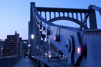
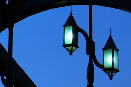
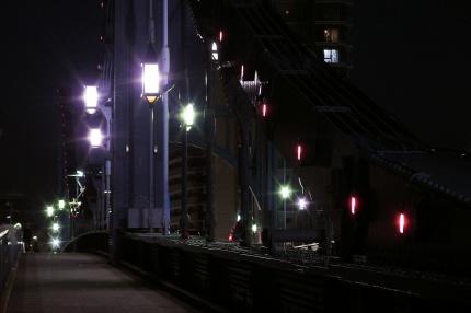
By the way, Mr. Kiyosu Bridge with such memories is now being recolored. This is a work to replace the highly decorative lighting fixtures that decorate the bridge with those designed at the time of construction.
Even today's decorative lighting is very good. I think it is often thought of with a design incorporating curves. It seems to have been changed to this design one day, and as far as you can see the old photos, this decoration has been attached for about 30 to 40 years.
However, Kiyosu Bridge is a suspension bridge that has been designated as a national important cultural property, and its design philosophy is highly evaluated.
From the beginning of construction, a civil engineering heritage designed with the image of a woman in contrast to a powerful masculine Eitai Bridge. So this construction is a recoloration that will return to the figure based on the design philosophy. The same color modification is being carried out at Eitai Bridge.
(A part of the design that changes this time. In the Hashizume River of Kiyosu Bridge The lighting of this design is left in the form of a monument.
With the reconstruction of the Great Kanto Earthquake, many bridges were built over the Sumida River. However, the design is not the same as one.
Among those bridges, Kiyosu Bridge was the most expensive one. It is said that women would cost money, but that was the same on the bridge.
It was built to imitate the Great suspension bridge in Cologne, Germany at the time, but when the bridge was built, the view of the bridge seen from the Mannen Bridge on the Onagi River in Koto-ku was praised as "the view of Cologne."
Construction was completed in March 1928. We are celebrating the 90th anniversary of this milestone.
Mr. Kiyosubashi returns to his appearance 90 years ago. I'm looking forward to seeing you again.
|
MenuArchiveLinks |

 That's why I finished in 3 hours and 9 minutes.