List of Authors
>>About this blog
Recent blog post
|
[Sam]
Nov. 11, 2018 18:00
  On November 8, the "Candle Tree", which resembles the Tokyo Sky Tree as a candle that continues to burn powerfully while shaking, lights up. On November 8, the "Candle Tree", which resembles the Tokyo Sky Tree as a candle that continues to burn powerfully while shaking, lights up.
Two types of Christmas limited lighting, "Champagne Tree", which looks like a Christmas tree, are starting to light every other day.
Lighting date: November 8-December 25
During the period, entitled "TOKYO SKYTREE DREAM CHRISTMAS 2018", "Christmas Love Song Live" on the Tenbo Deck overlooking a night view of 350m above the ground, participatory mini show "Sorakara-chan's HAPPY Christmas 2018", Christmas costume Sorakara-chan "Christmas Greeting" Screening with various Christmas screens SKYTREE" with the super panoramas on the Sky Deck. From the Sumida River Ohashi, a Christmas-colored frame shines over Kiyosu Bridge.
[Hikoharu Co., Ltd.]
Nov. 11, 2018 14:00
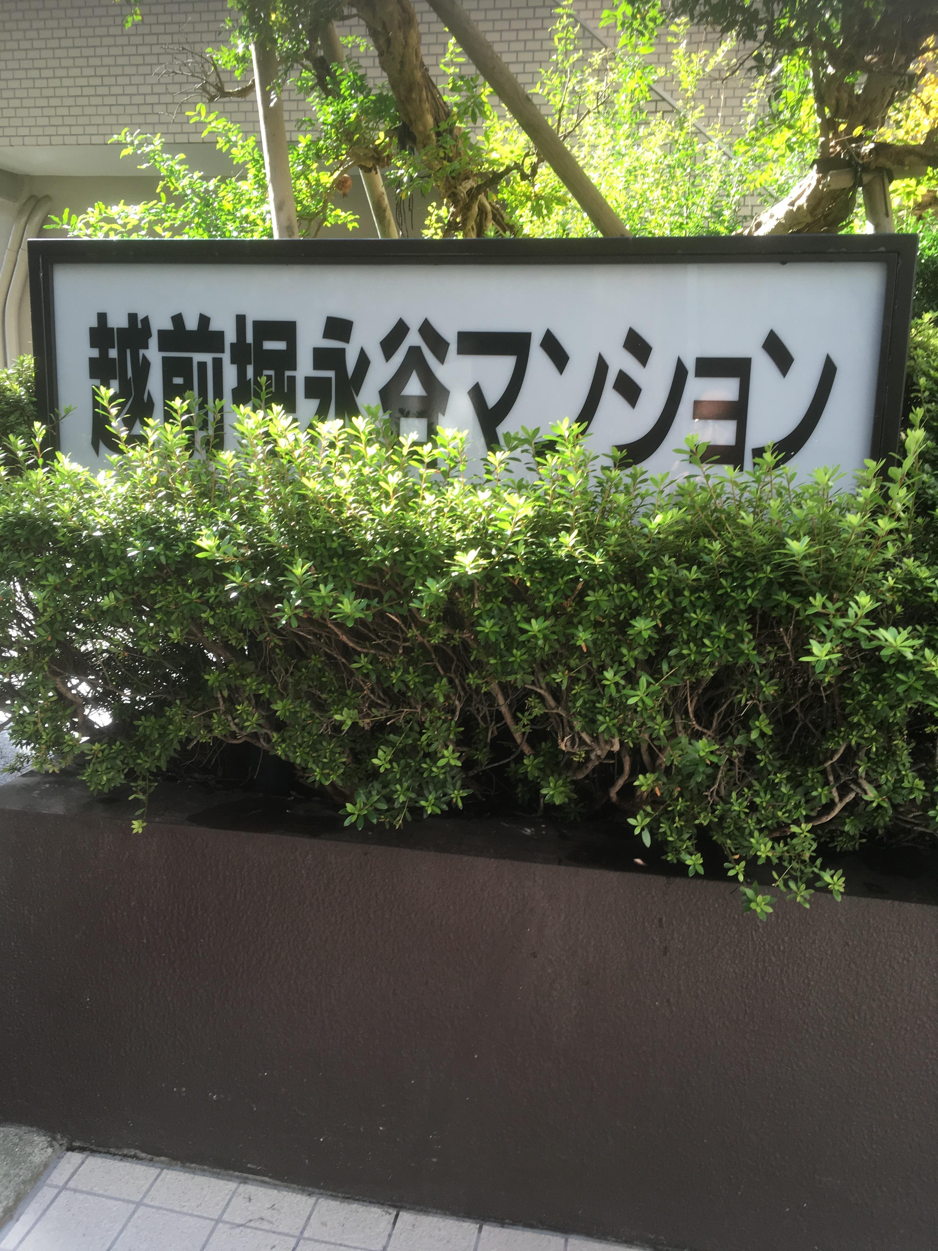
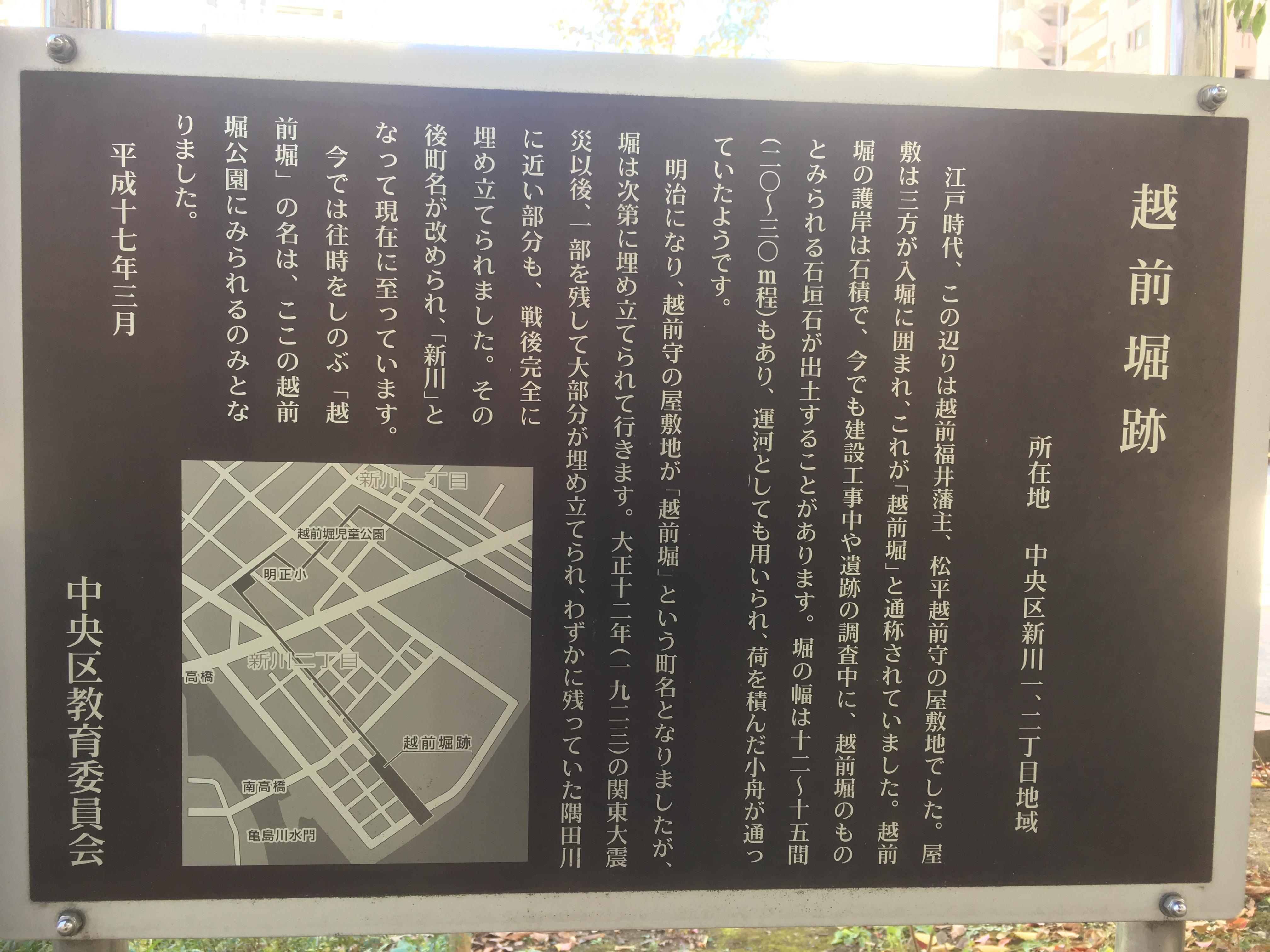
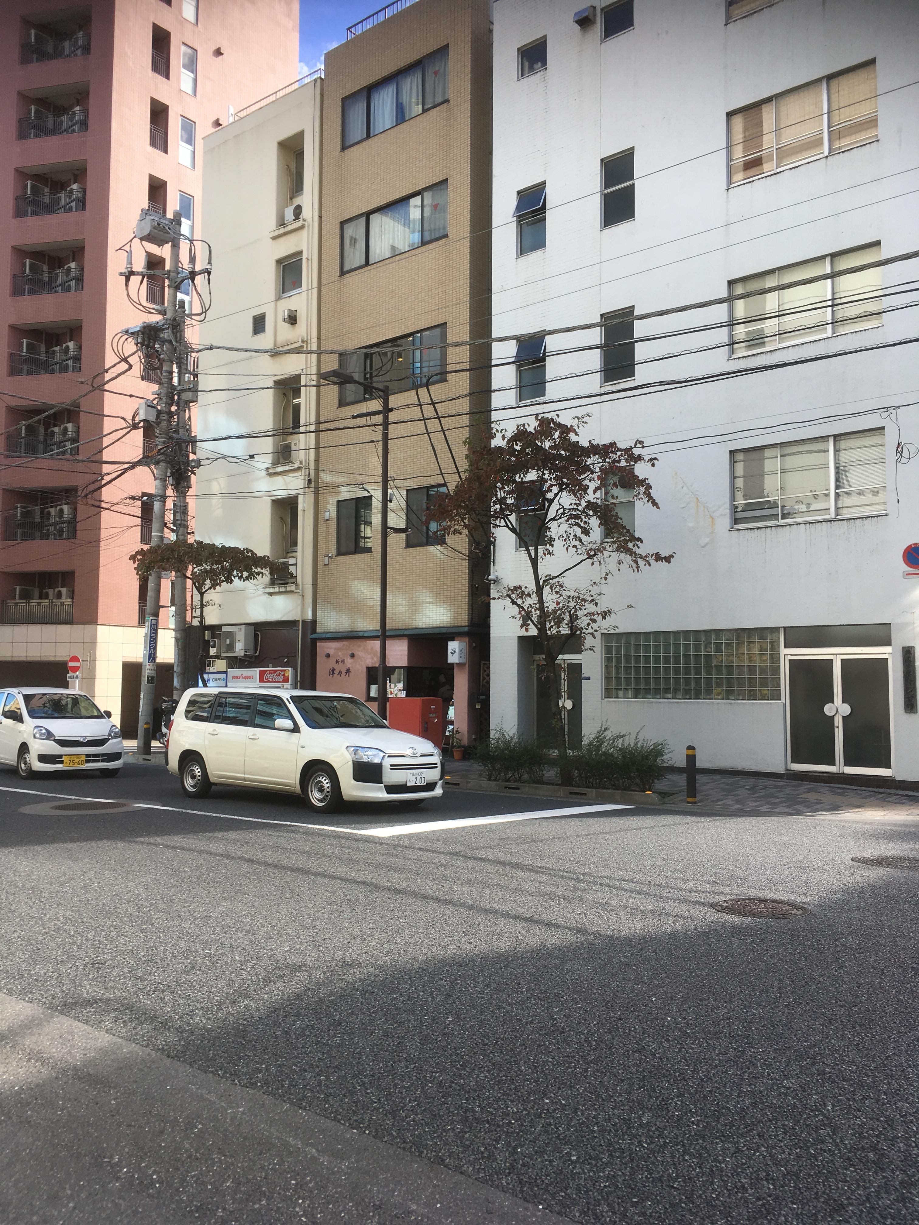
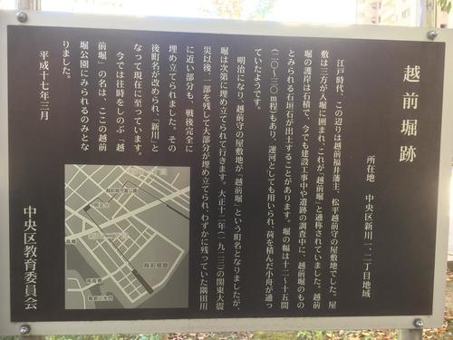
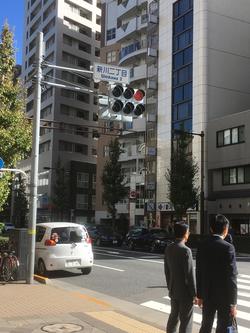
Echizen moat was a moat surrounding the Matsudaira Echizen Mamoru Nakayashiki in the Fukui Domain, and was built with bridges such as Kaijo Bridge and Sakae Bridge. This time, we are planning to walk around the ruins of Echizen moat. At the current address, start from Shinkawa 1-chome along the Sumida River, cross the Echizenbori Children's Park, cross the Akimasa Elementary School diagonally, go along Yaesu-dori toward Tsukuda near Shinkawa 2-chome, and join the Sumida River again. It becomes.
 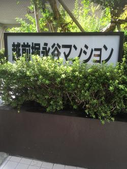
It will be a start from the vicinity of the right bank of Shinkawa in the previous project. Even now, there was an apartment where the place name of Echizenbori was left. It seems that Echizen moat had passed through the premises of this apartment.
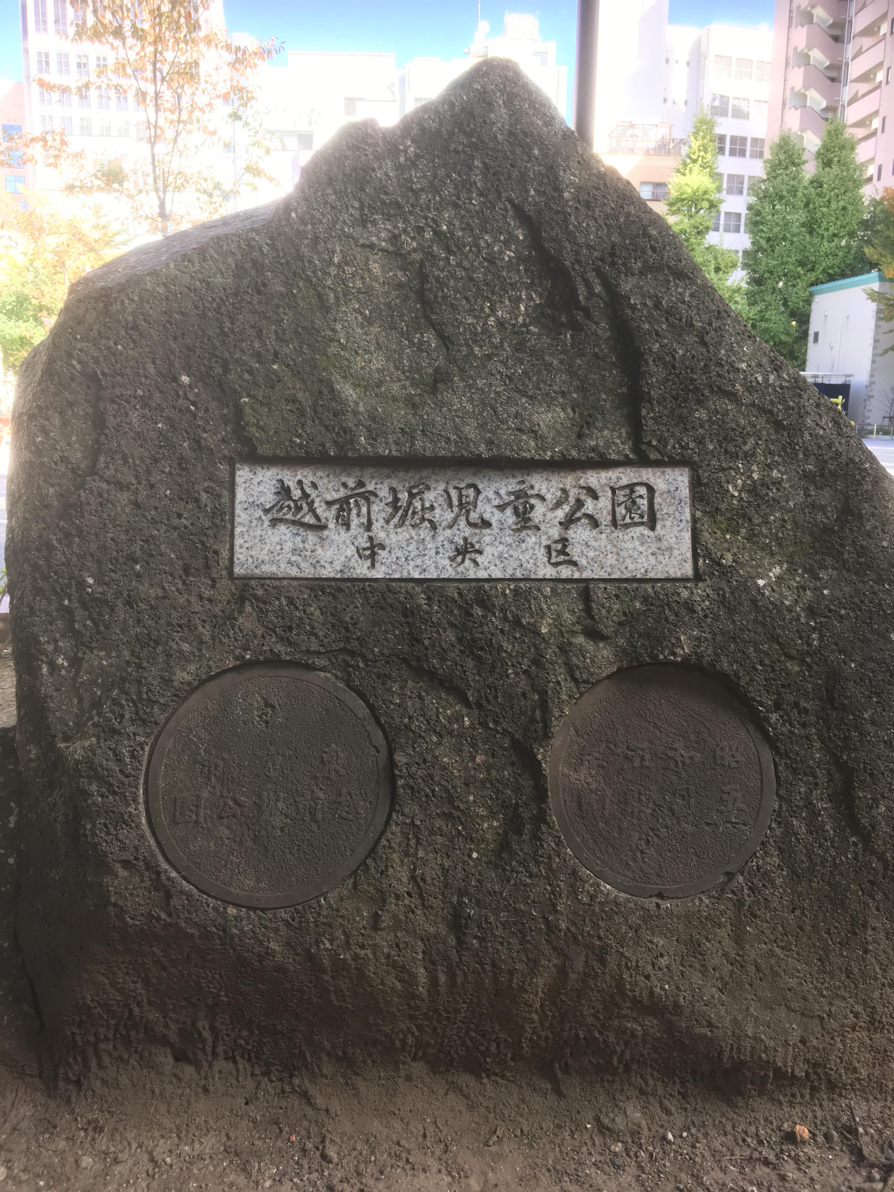
And when you cross Kajibashi Street, you will see Echizenbori Children's Park on your left.
 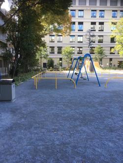
Echizenbori changes the direction to the south in this park and heads to Akimasa Elementary School.
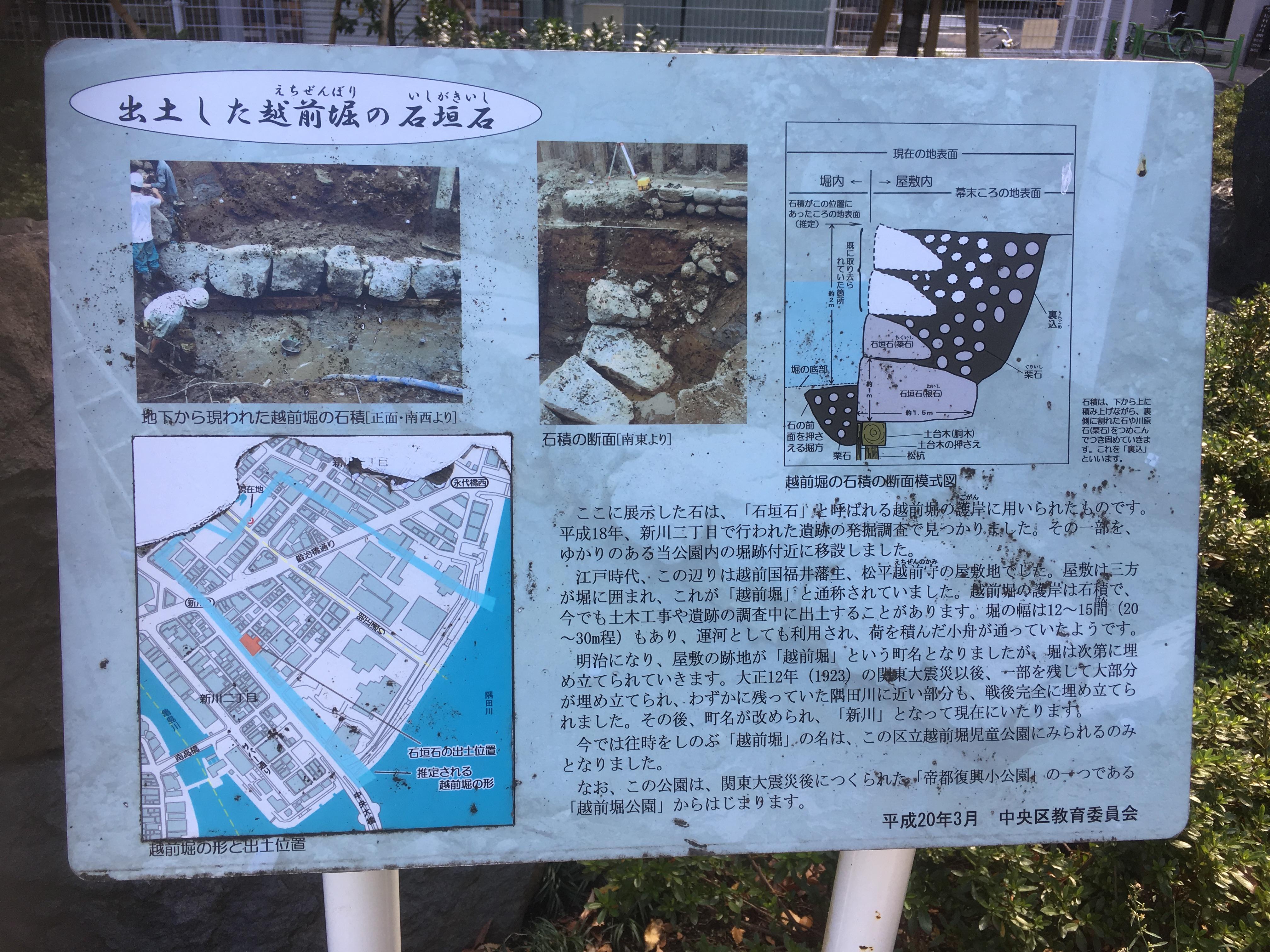
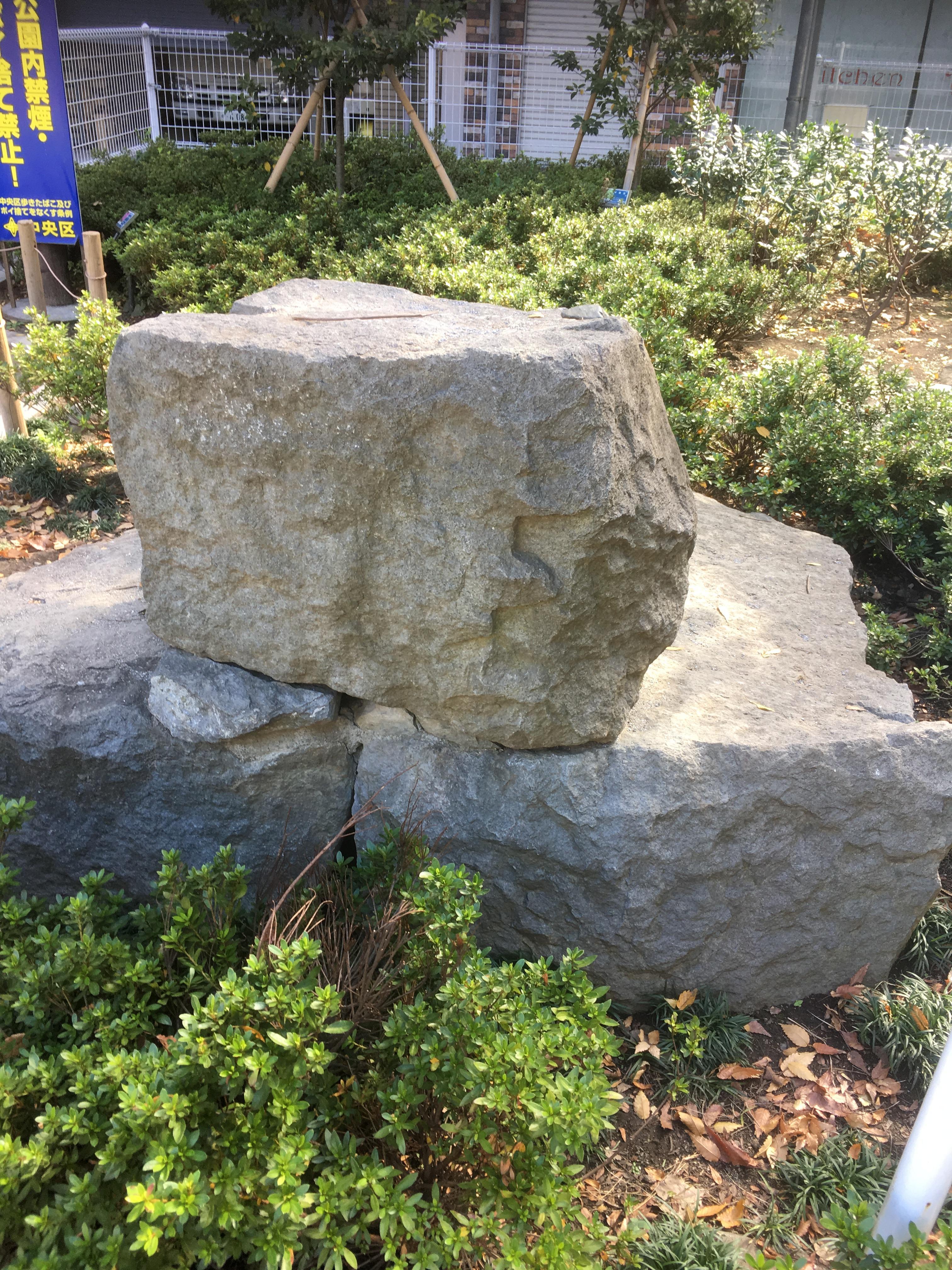
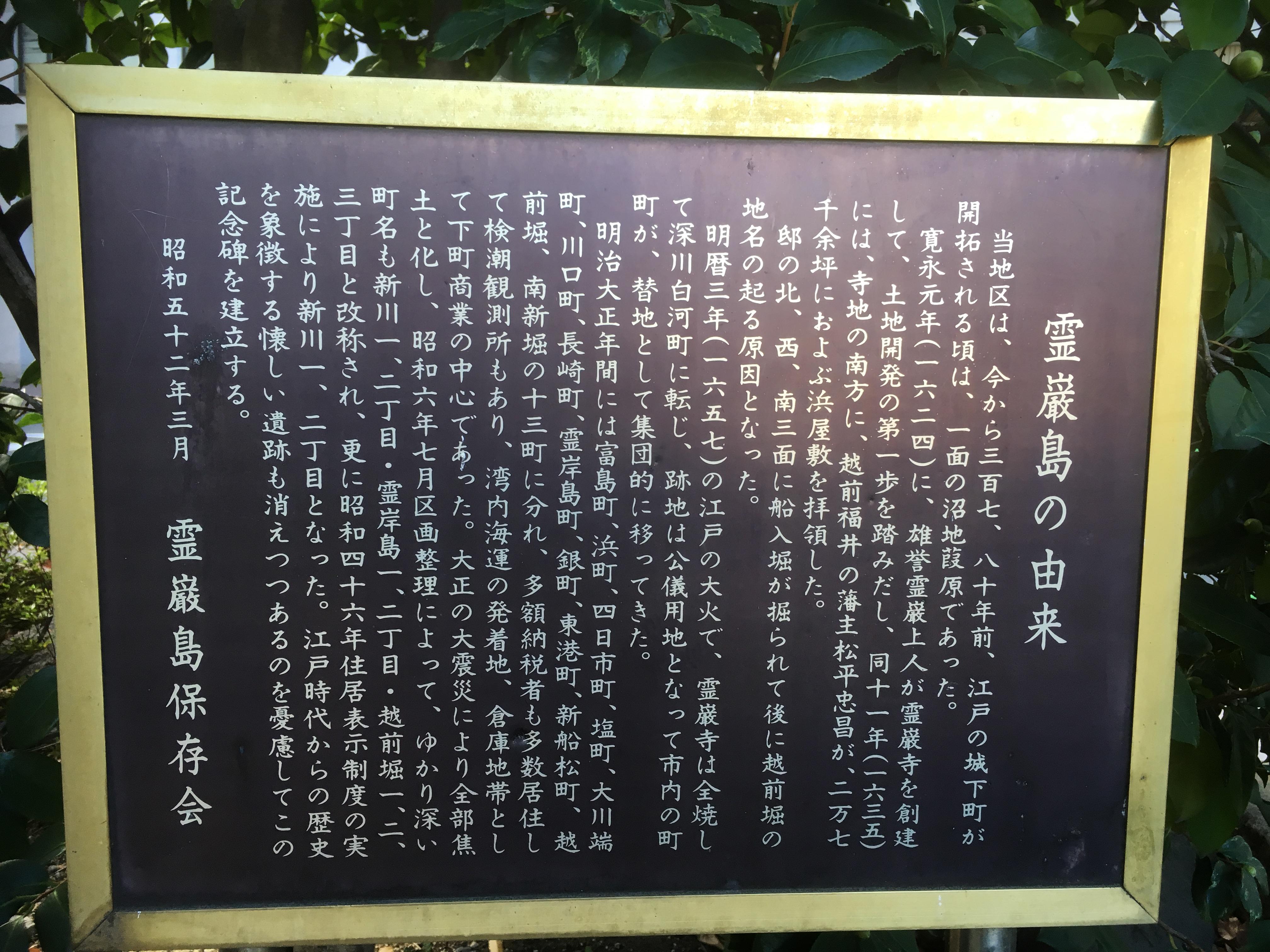
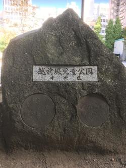
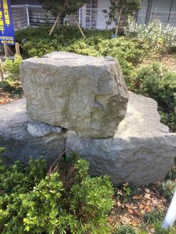
In Echizenbori Children's Park, there are information boards for the ruins of Echizen moat and stone walls that have actually been excavated.

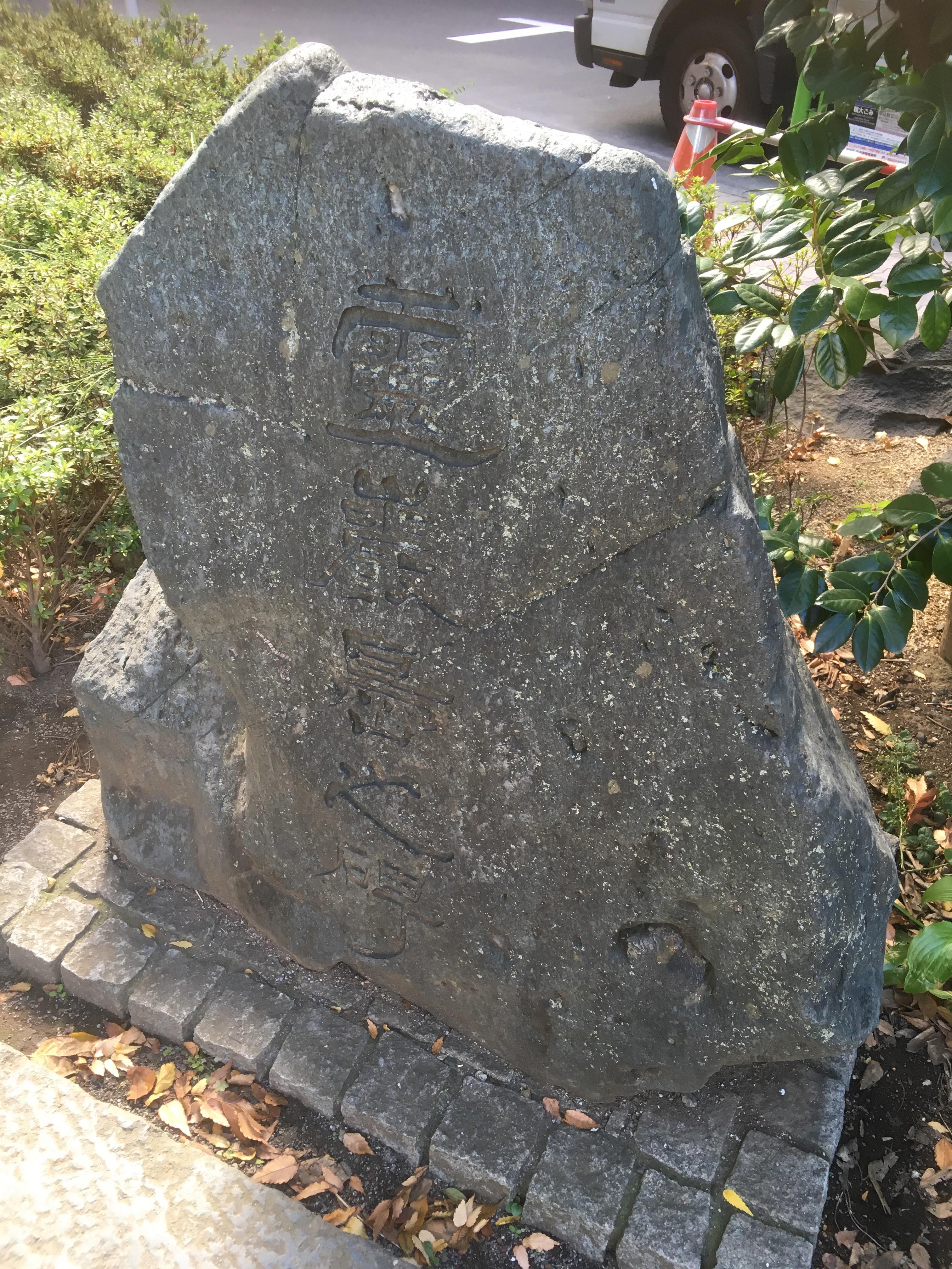
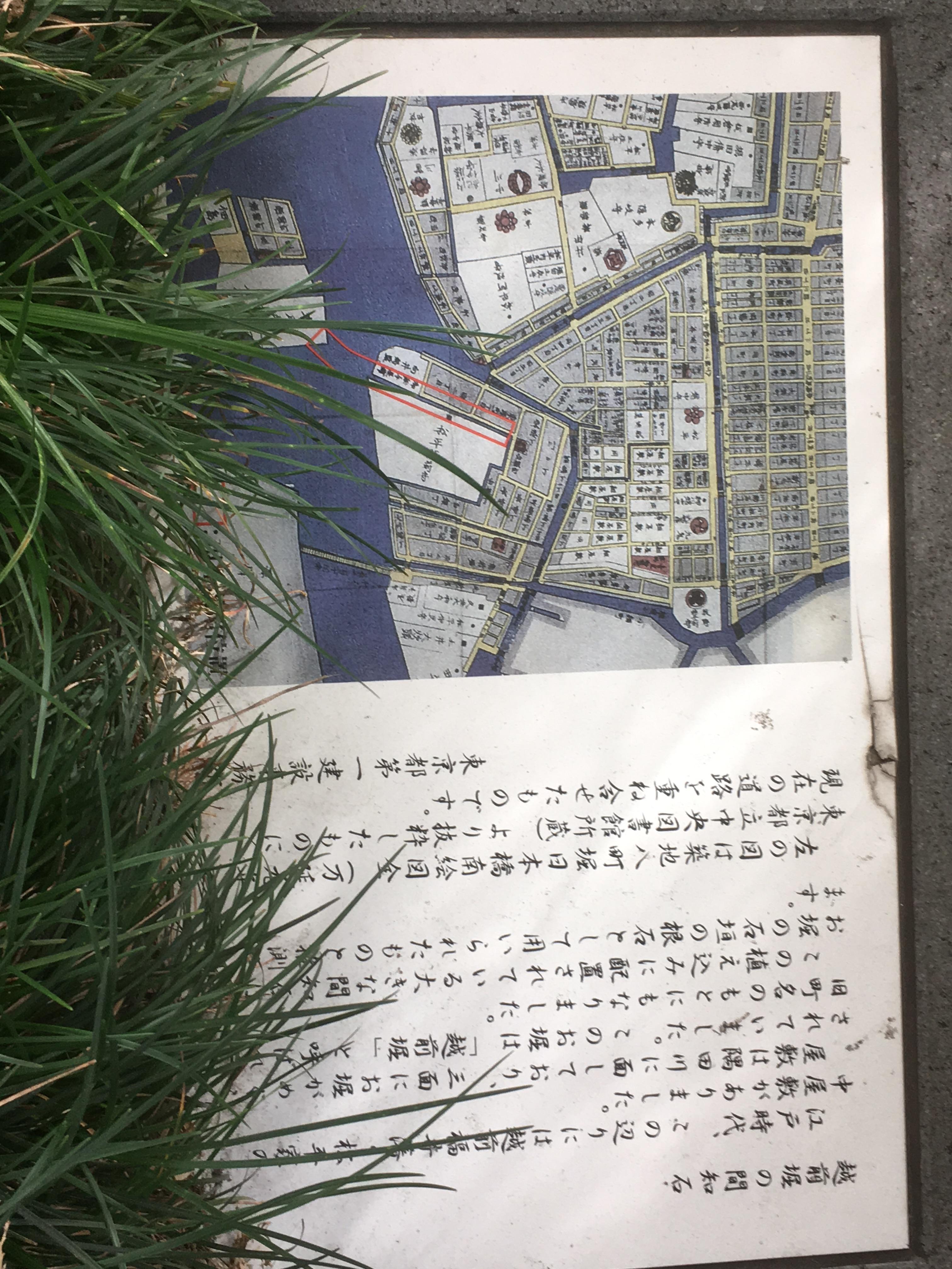
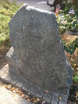
And there are stone monuments of Rei Kishijima, explanation boards about the origin of Rei Kishijima.
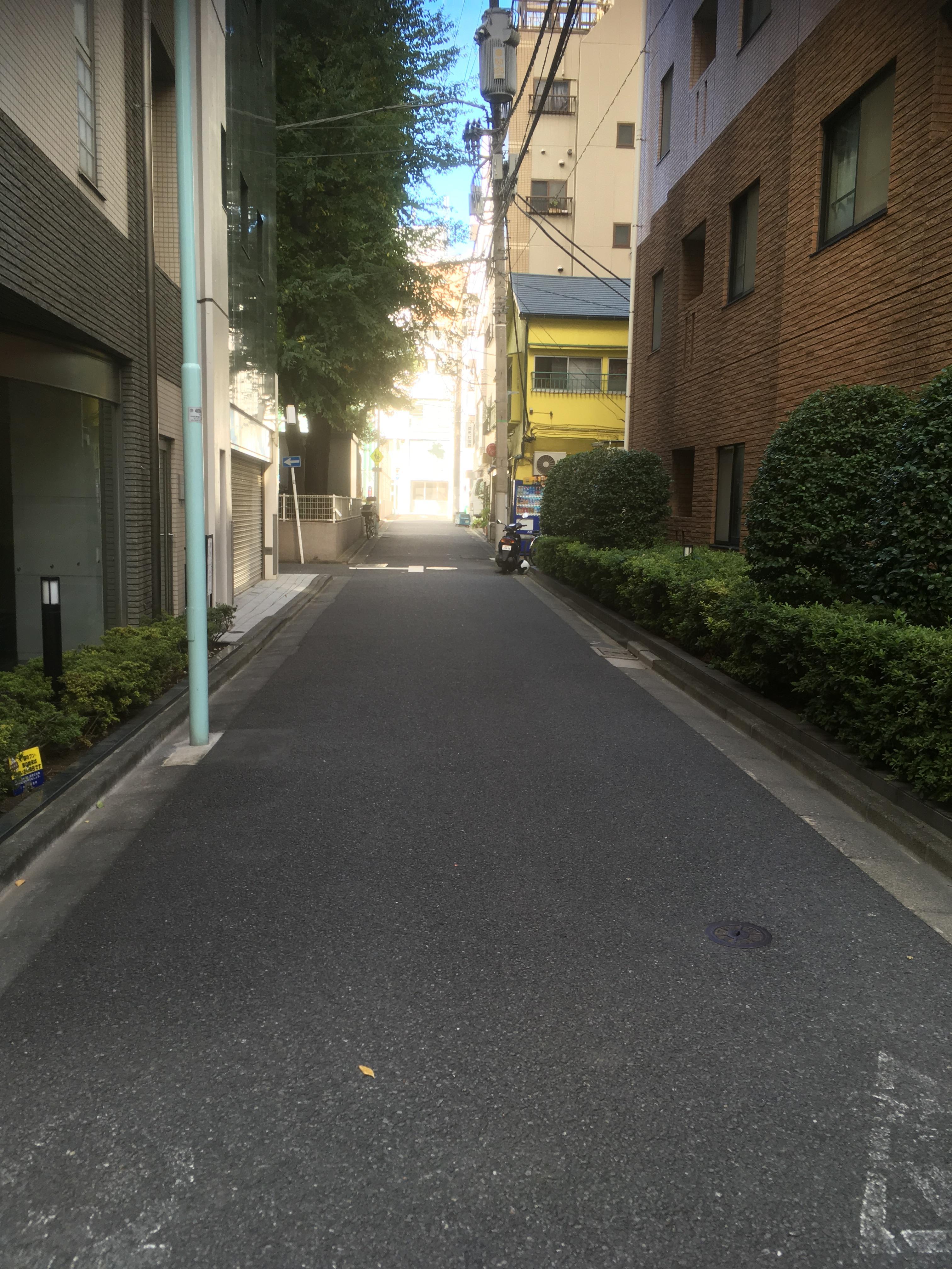
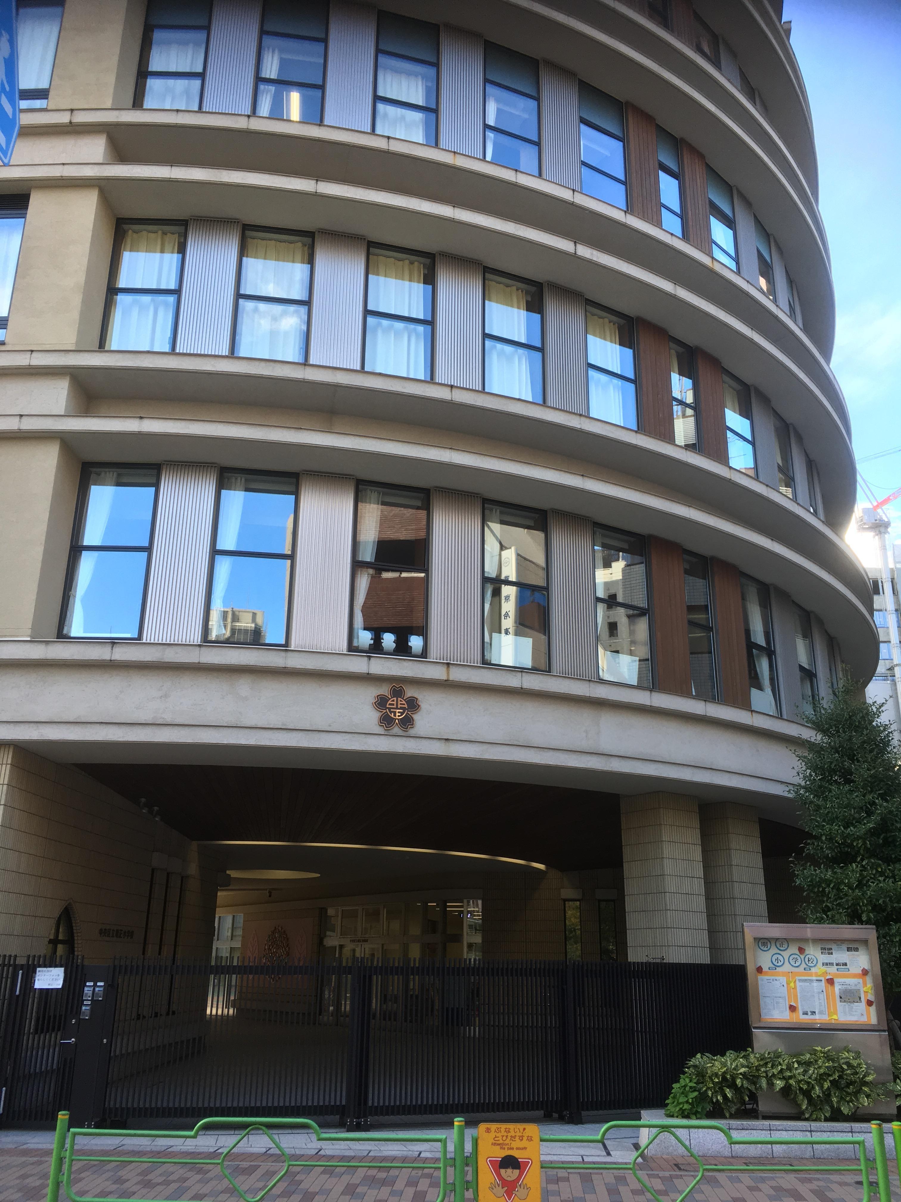
Then, break diagonally in the school grounds of Akimasa Elementary School and proceed along Yaesu-dori toward Tsukuda.
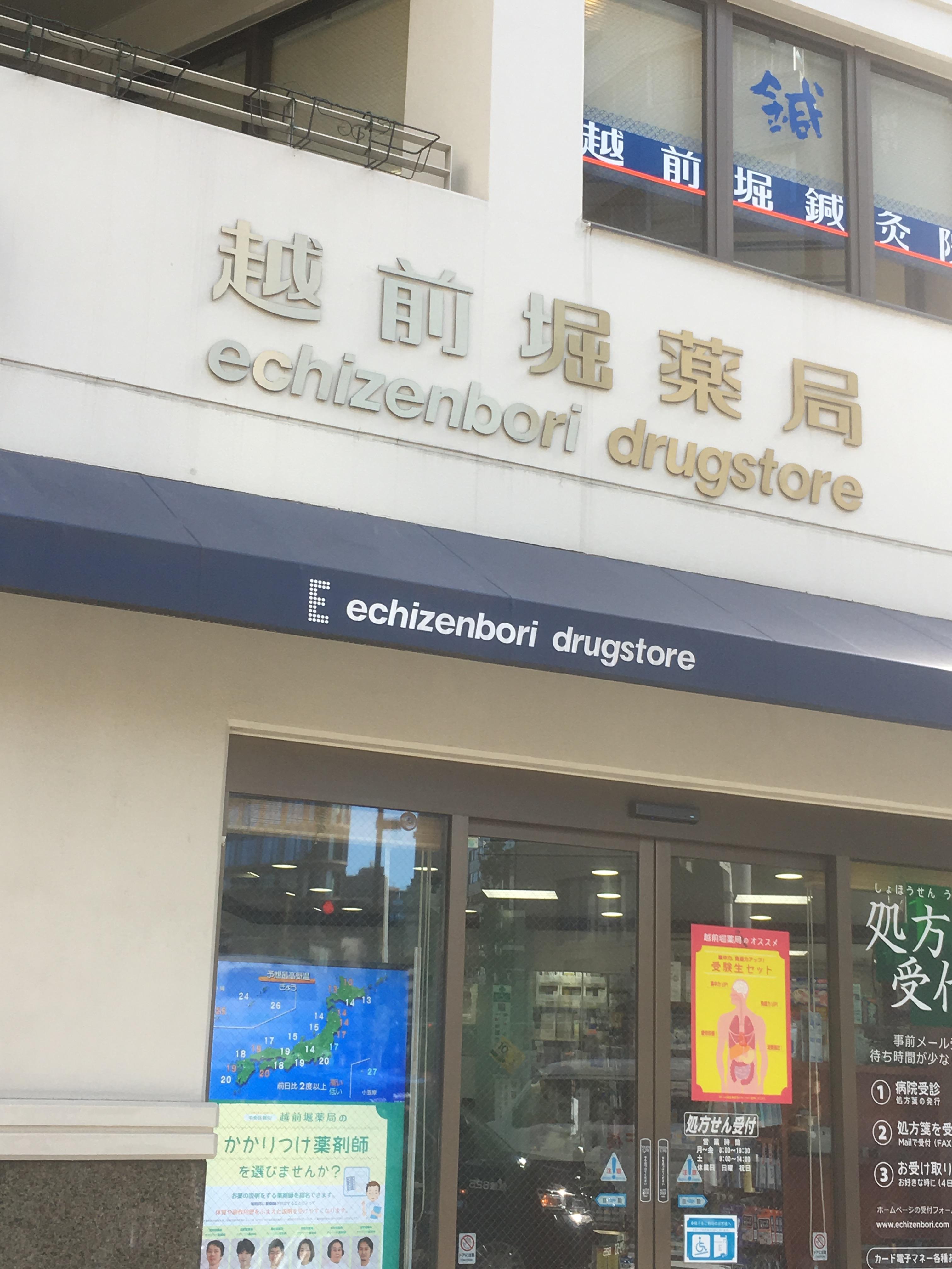
At the intersection of Shinkawa 2-chome, there was Echizenbori Pharmacy, which claims to be "Echizenbori".
This Echizenbori Pharmacy is a pharmacy with a history of starting a drugstore in 1923 (1923).
In the planting in front of the shop, there was an explanation board of "Echizenbori no Machiishi".
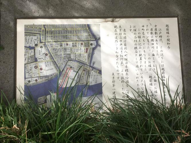
In front of you, you can see the apartments of Chuo-ohashi Bridge and River City 21.
Now, Tsukuda is in front of you.
Like last time, traces of Echizen moat could not be found.
And now, the address display of "Echizenbori" has disappeared, but it was barely left with the park name, apartment name, and store name, and I was able to discover it.
Even so, the Daimyo residence in the Edo period was big! I felt like walking around the city.
[Hikoharu Co., Ltd.]
Nov. 10, 2018 14:00
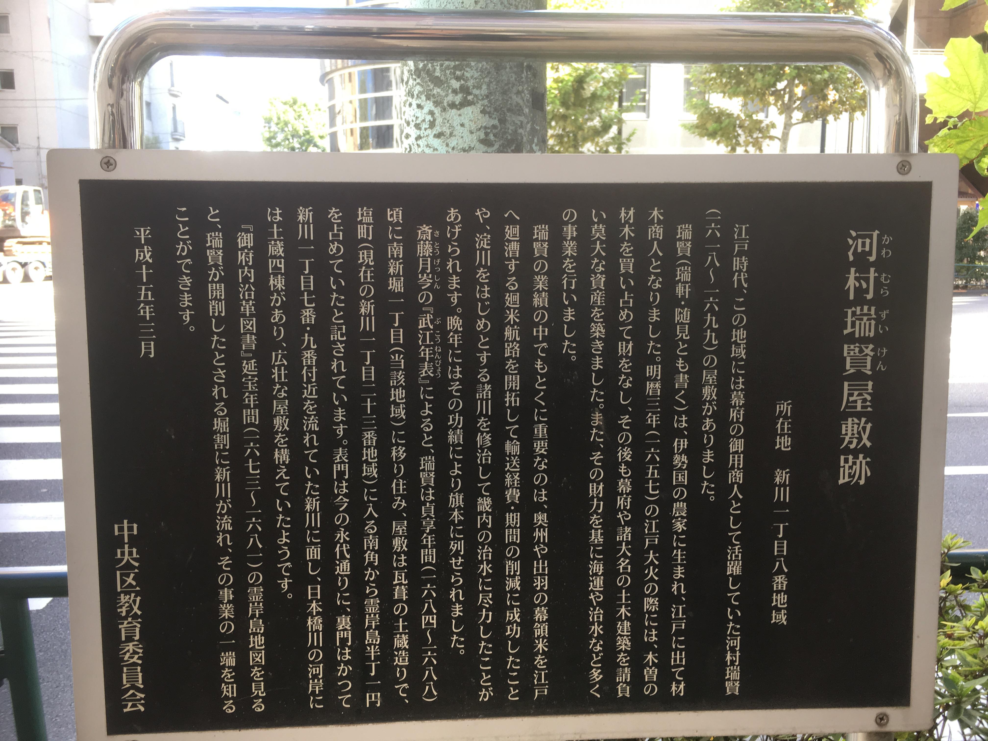
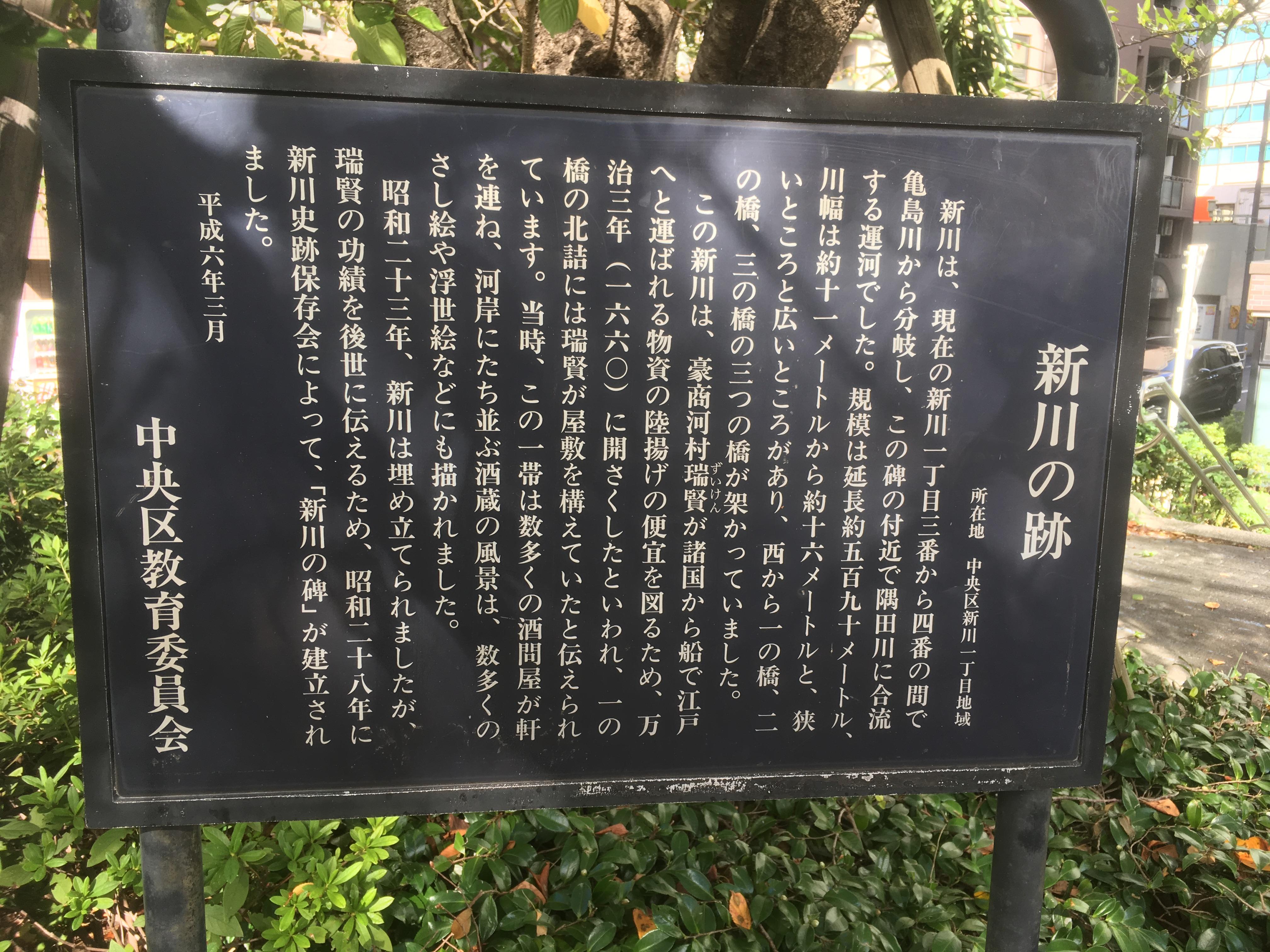
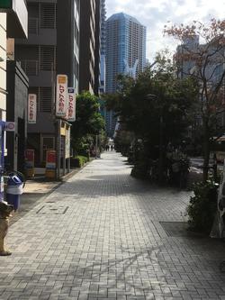
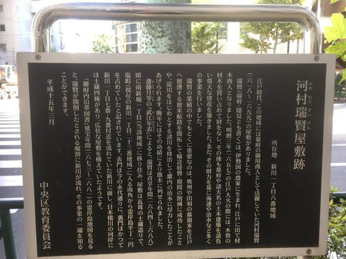
This project is to walk along the ruins of Shinkawa, which was excavated by Zuiken Kawamura in 1659.
I walked from the confluence of the Kamejima River and Shinkawa (near Shinkawa 1-chome No. 3) to the stone monument at Shinkawa Park at the confluence of the Sumida River and Shinkawa.
The Shinkawa flowed through the current Shinkawa 1-chome. In Shinkawa, three bridges were built from the west: Ichinobashi, Ninobashi, and Sannobashi. From the Edo period, liquor stores and sake brewery were lined up on both banks, and until the Meiji and Taisho eras, many liquor wholesalers, local liquor wholesalers and wholesalers were gathered. However, after the Great Kanto Earthquake and the Great Tokyo Air Raid, Shinkawa, the center of Tokyo's liquor wholesale business, was completely destroyed.
In Shinkawa, landfill work began in 1948 (1948), and construction was completed in the following year 24.
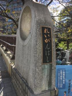 
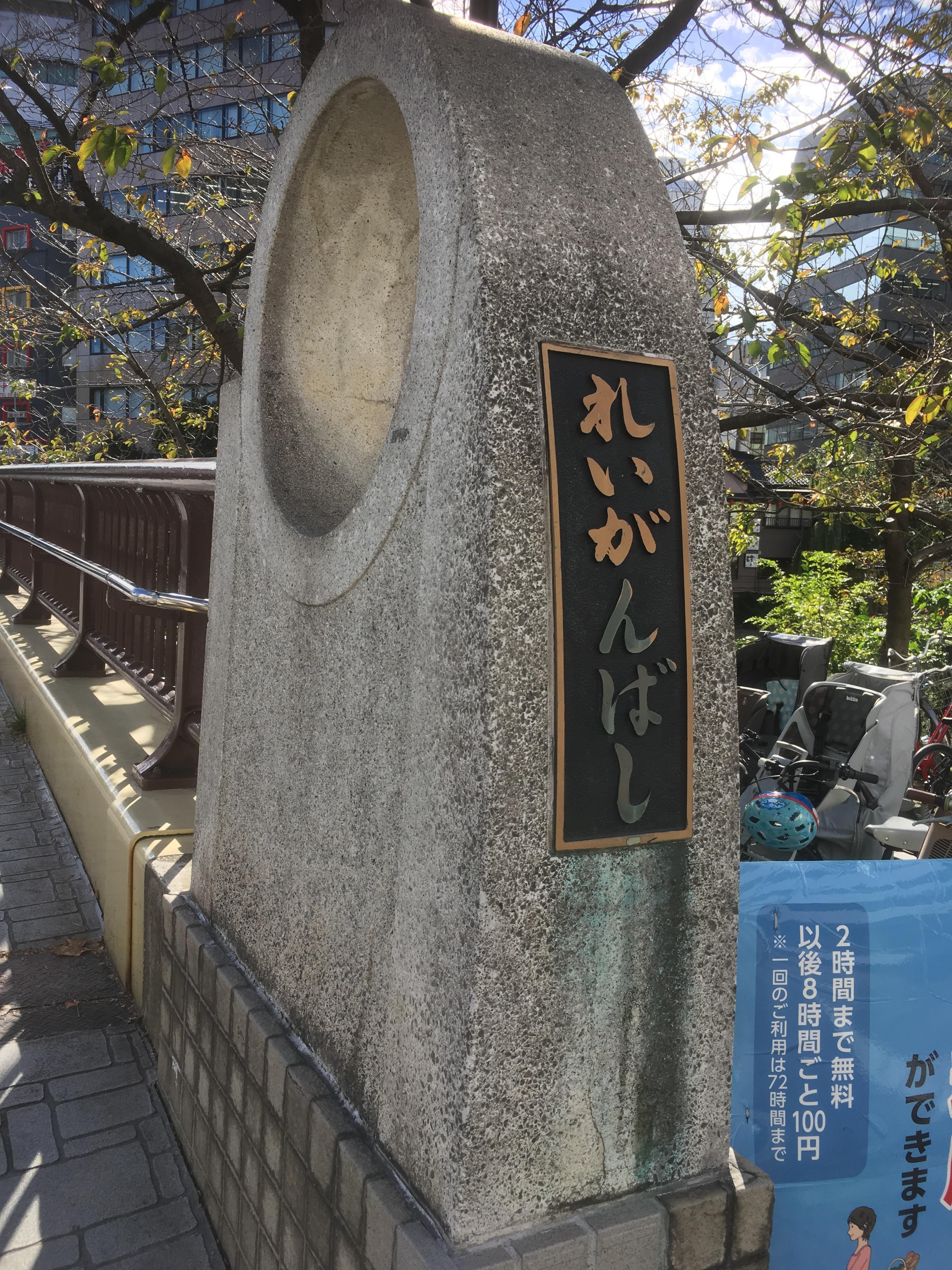
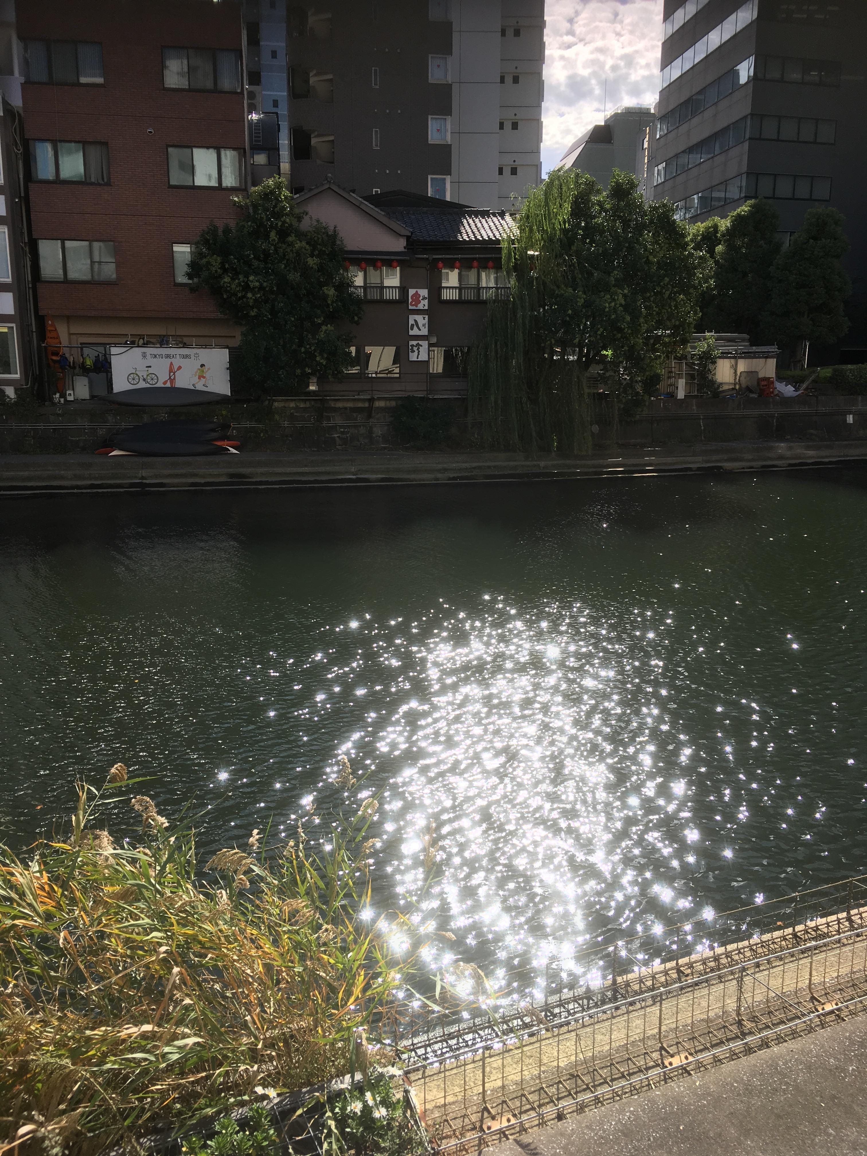
The start is from Reigishi Bridge. If you look at the opposite bank from the bicycle storage area at the base of Reigishi Bridge, you can see a dark green place. This is the confluence of Shinkawa and Kamejima River. I watched the seawall, but I couldn't find any traces like that.
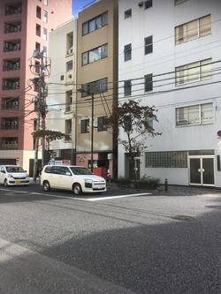
The photo above is near Ichinobashi. And when you return to Eitai-dori St. a little, you will find an explanation board of the site of Zuiken Kawamura mansion.
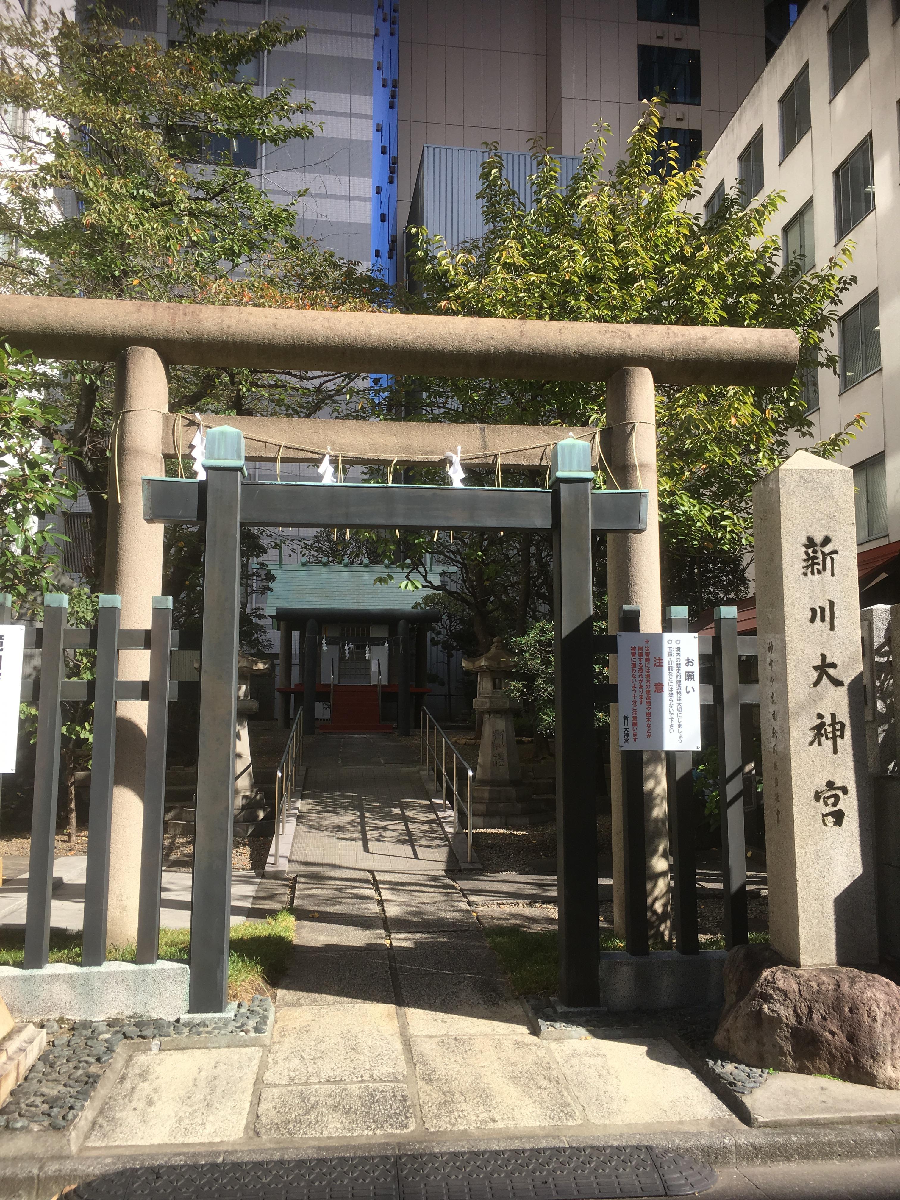
And on the left bank of Shinkawa, there is Masaru Shinkawa Jingu Shrine.
 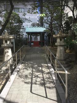
I studied a little bit about Masaru Shinkawa Jingu Shrine.
"It is Chisan Dojin in Yokkaichimachi, Masaru Shinkawa Jingu Shrine. During the Kanei era, both grand shrine and Shinmei-gu Shrine, when Ise inner shrine's priest Keikoin Hiokani came to Edo, he worshiped the mansion here and made it a travel pavilion, recommended both inside and outside Ise, and made it a place of worship. It is one of the most popular places in Edo during the Bunsei and Tenpo. "
From "History of Chuo-ku"
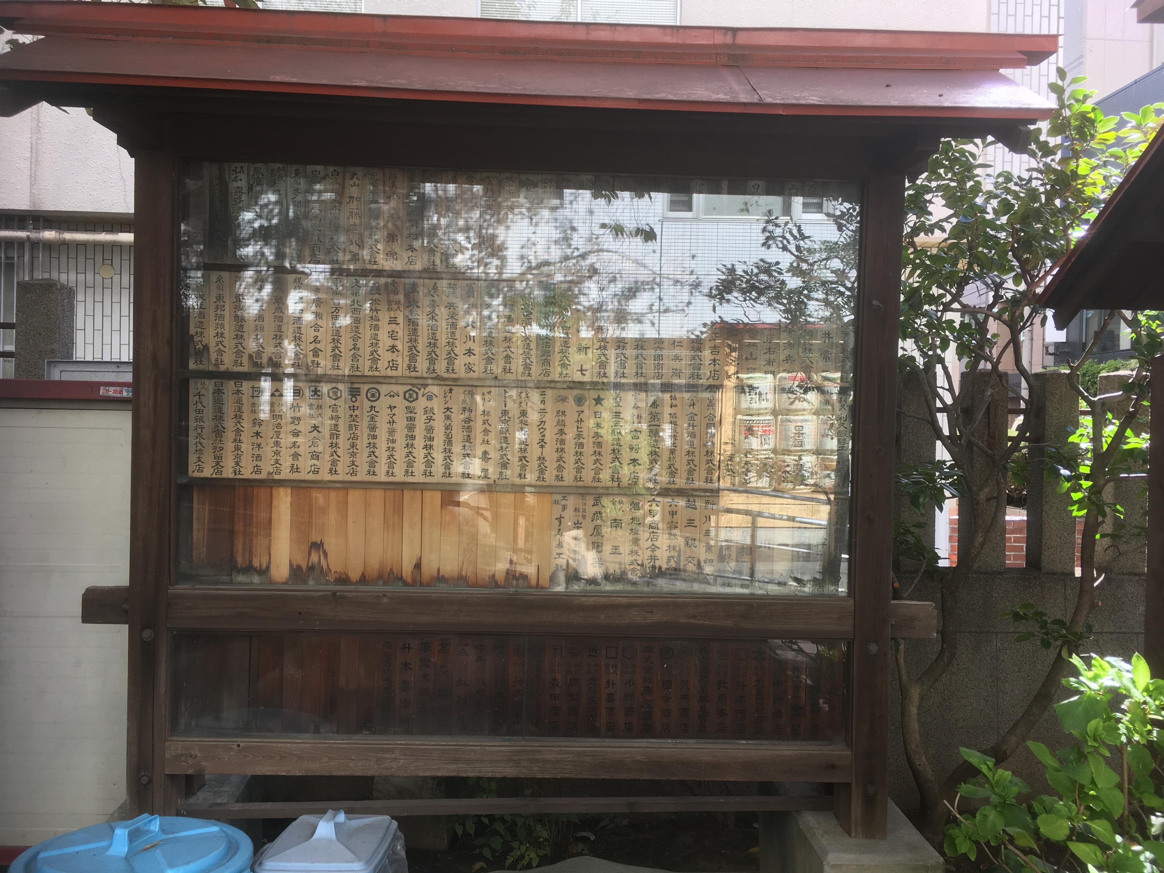
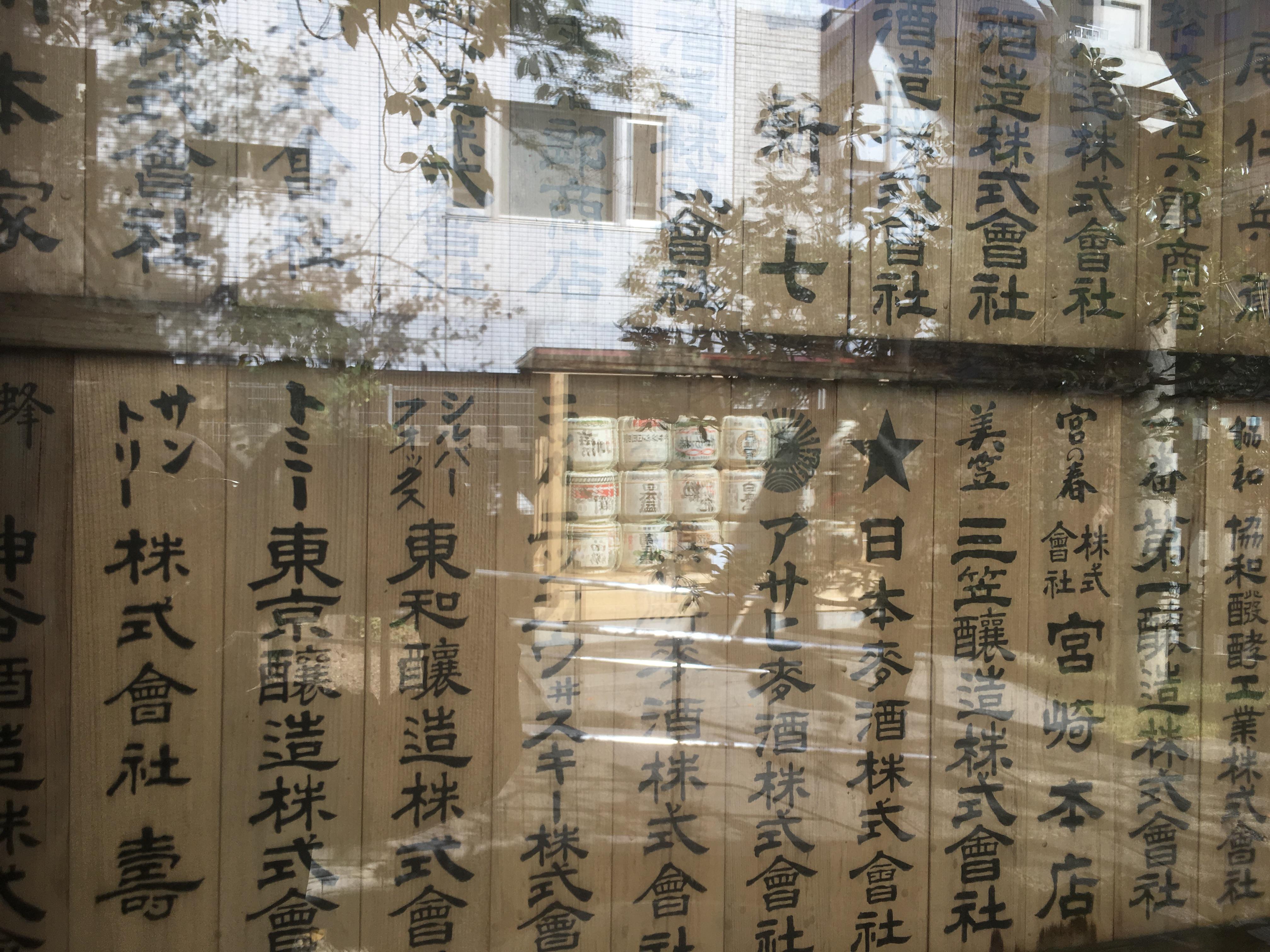
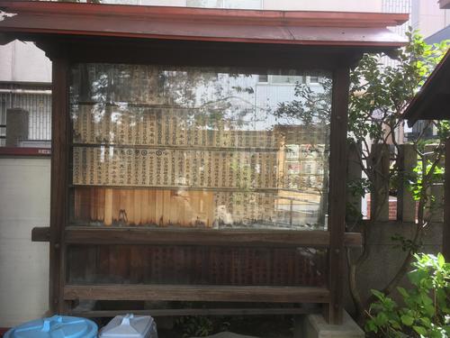
Let's take a look at the votive board. Even now, you can still see the names of companies related to alcoholic beverages.

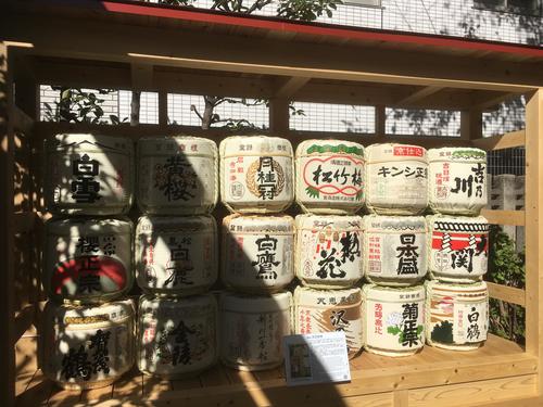
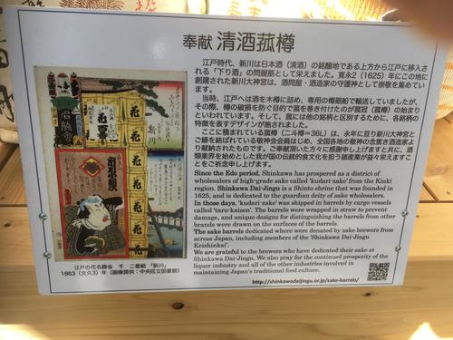
After being held on October 17, Reitaisai festival in 2018, sake barrels were displayed in the northwestern part of the precincts.
 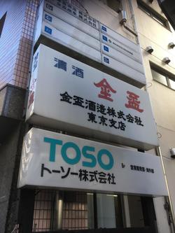
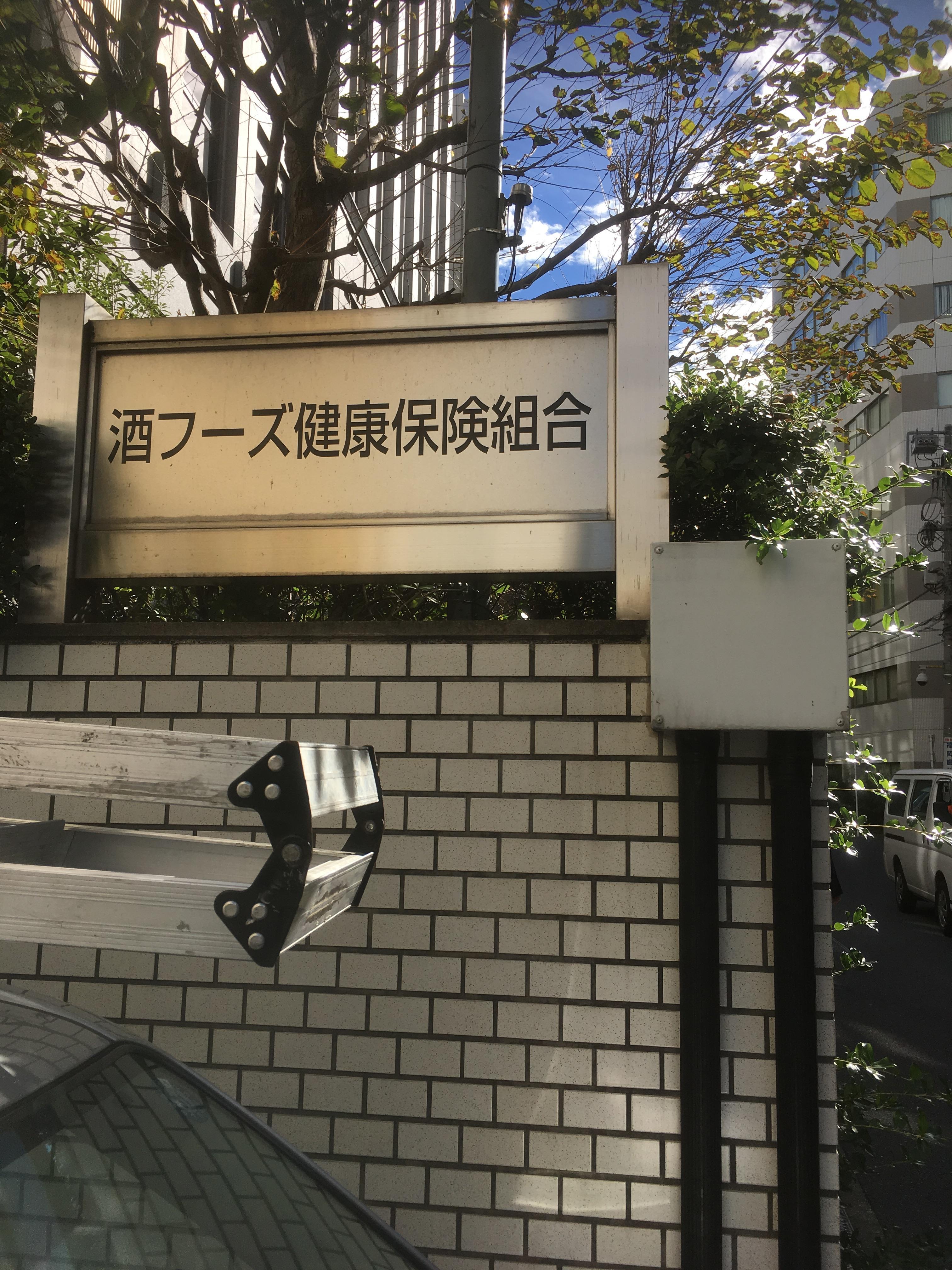
Even today, there was a building of the Sake Foods Health Insurance Association next to Masaru Shinkawa Jingu Shrine. Although the name of the liquor company is slightly near the site of Shinkawa, it can still be confirmed.
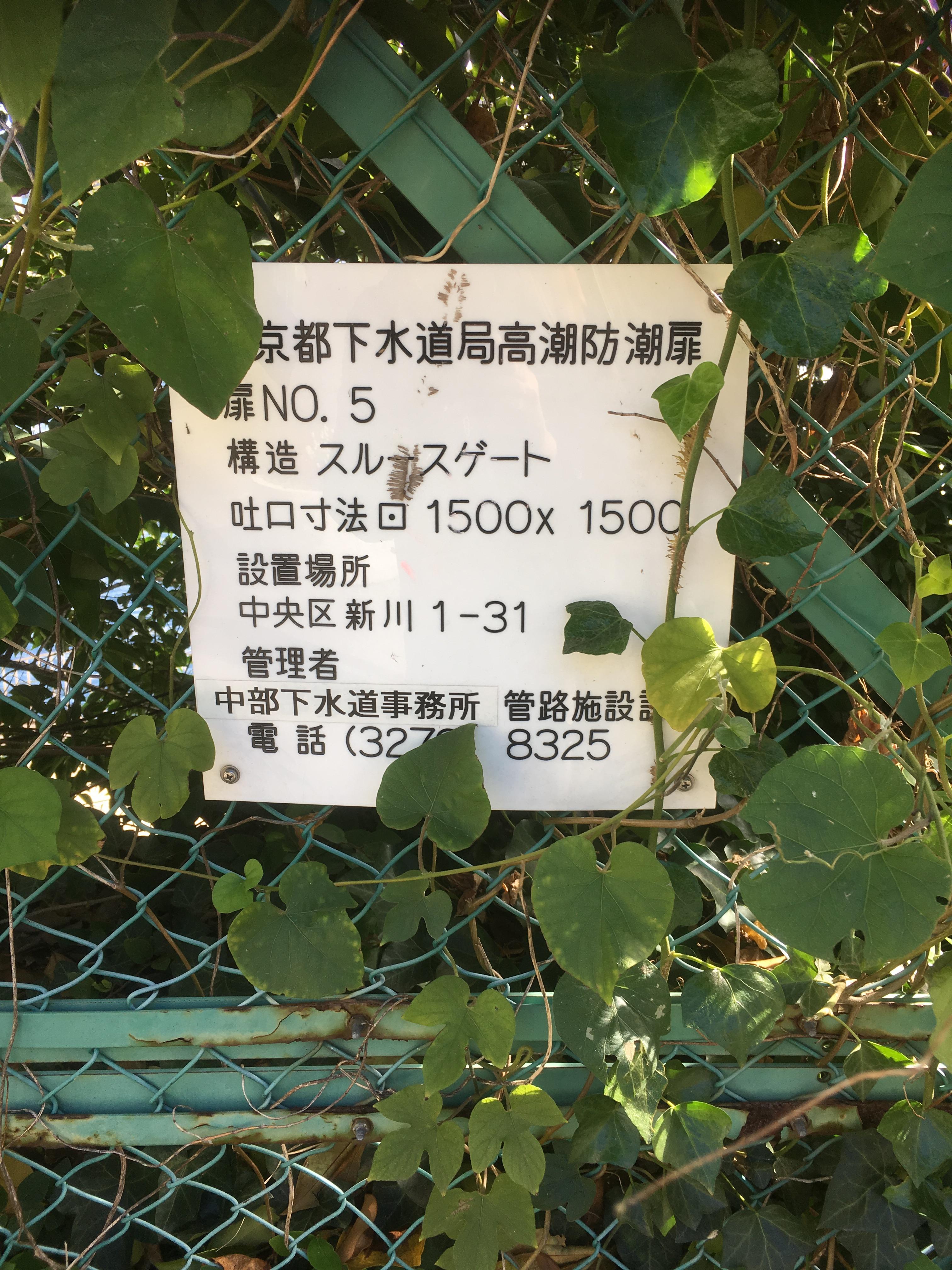
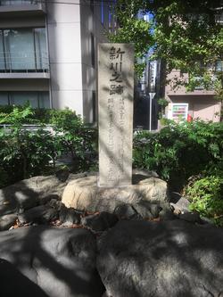
And this is Shinkawa Park. In Shinkawa Park, there is a stone monument of "Remains of Shinkawa" and an explanation board of the traces of Shinkawa.

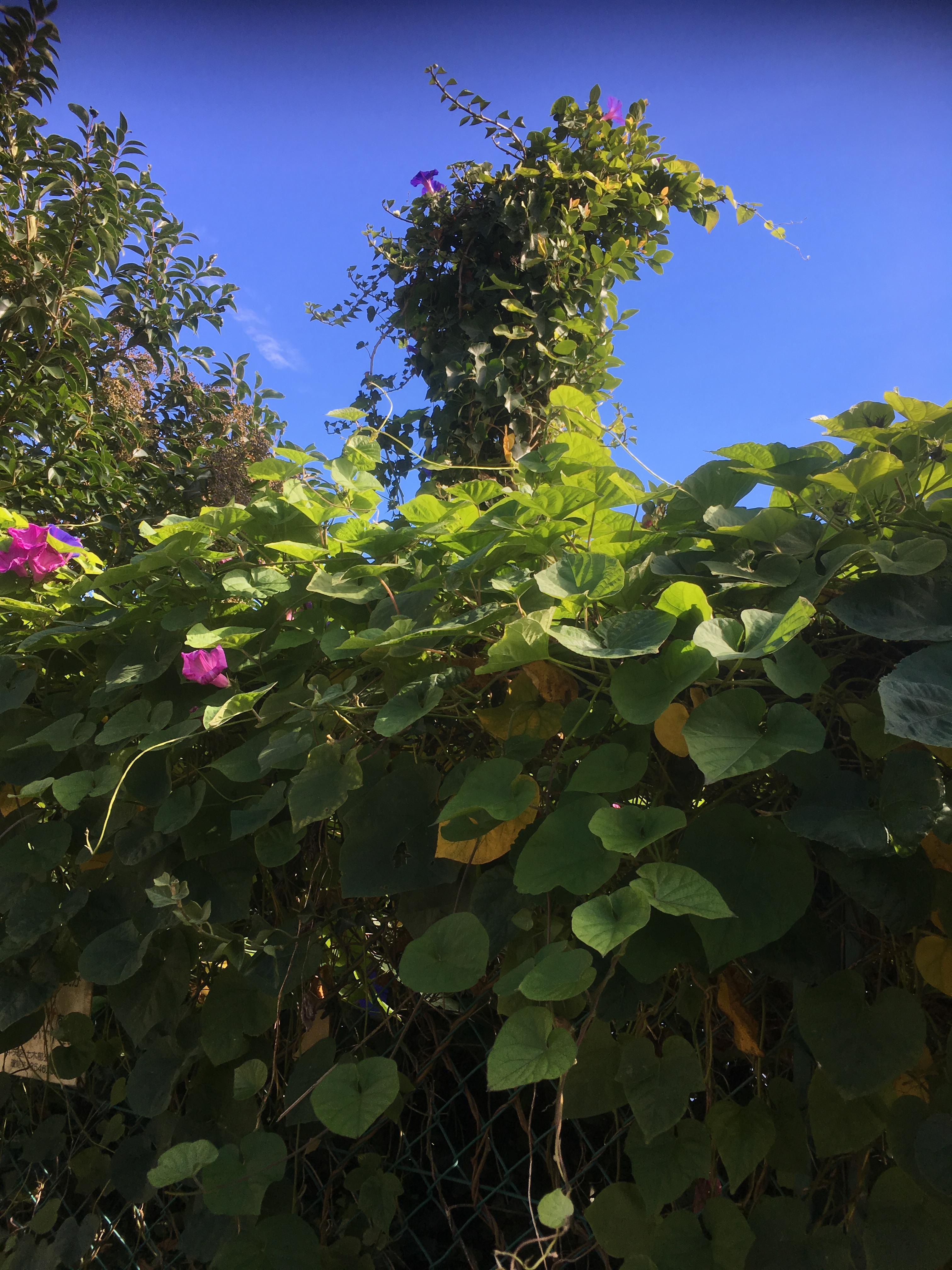
And I was able to see the sluice gate covered with ivy.
At the confluence with the Sumida River, on the left bank, there is Watakai Inari Shrine, which has been worried about for a long time.
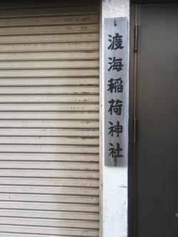
I don't know what is going on in the display of this Tokai Inari Shrine.
Is there a torii gate or shrine in this shutter? First of all, I wrote that the name of "Tokai" Inari Shrine crossed the sea, and the place was the Shinkawa entrance, so I was very interested in it and examined a little.
"Tokai Inari Shrine enshrined deity Uga Soulmei was founded in 1704 in Kamiji in the early Meiji era, became a common land in the city area, changed to 22 tsubo free lease. After the war, he was requisited by the Allied Forces and started reconstruction after the cancellation. 2,000 reverences."
From "History of Chuo-ku"
Since 1704 was founded in 1704 AD, it was founded after Shinkawa was excavated. Also, when checking the fireho map of the Showa 20s, the area around it is described as "U.S.N.COMMANDER NAVAL FORCES FAR EASTMOTOR POOL", and it seems that it was used as a centralized dispatch site for troops. . At present, I'm worried about what is going on inside this Tokai Inari Shrine.
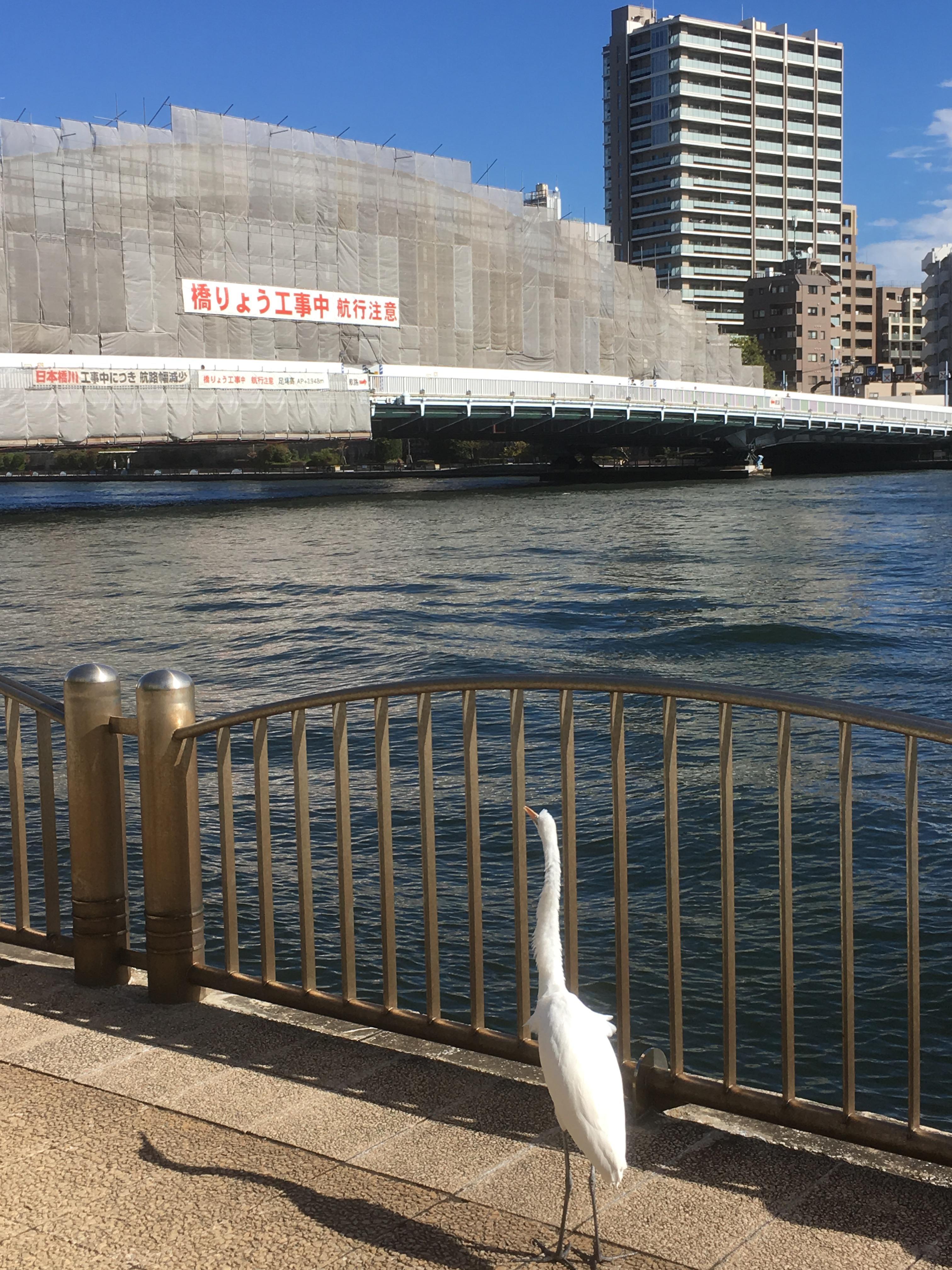
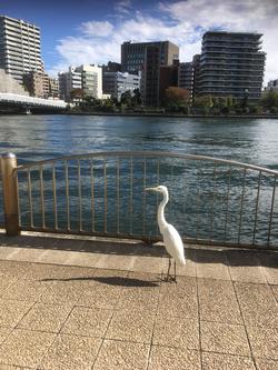
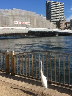
And finally, I went out to the Sumida River Terrace. What a bird like "Sagi" greeted me there. I was surprised at this.
When I walked along this Shinkawa site this time, I could not find any direct traces of Shinkawa, which had been reclaimed for the reconstruction of the war, but the fact that liquor companies gathered in Shinkawa and prospered for a while as a defeated country It was a city walk to reaffirm many things, such as what was being occupied.
[wienerhorn]
Nov. 3, 2018 14:00
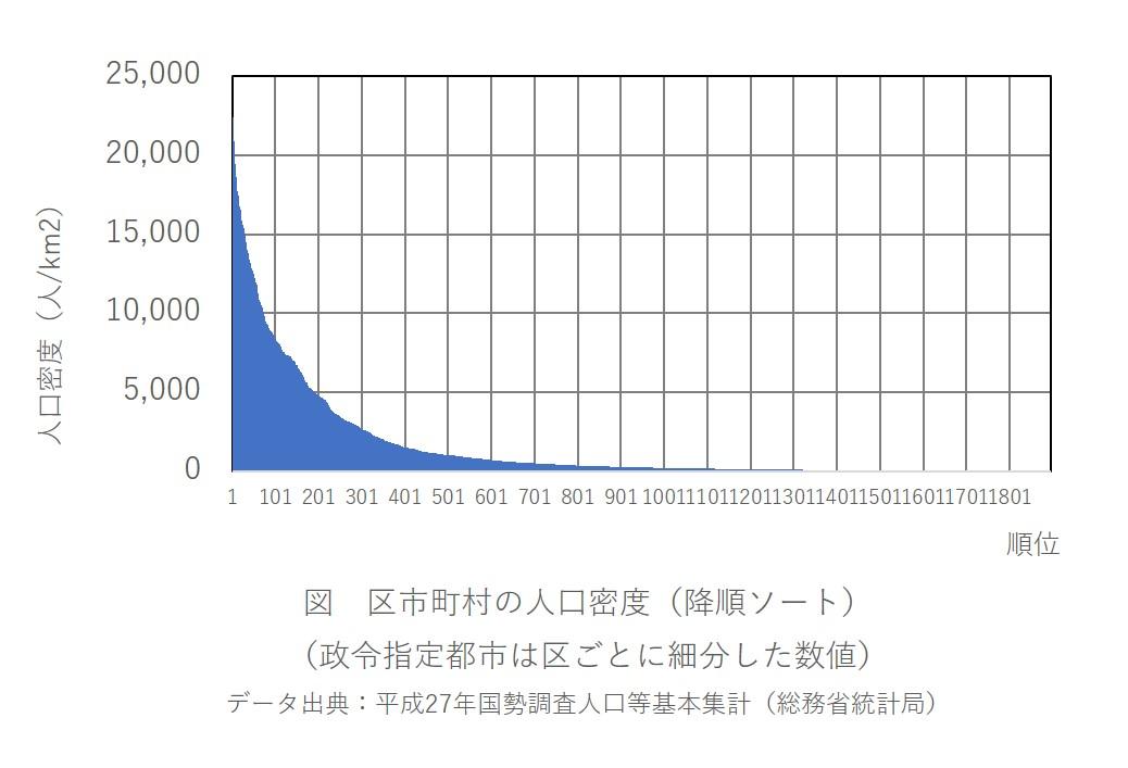
Based on the 2015 national census population basic count (Ministry of Internal Affairs and Communications Statistics Bureau), we made a ranking of population density by ward, municipalities.
Government-designated cities have been subdivided by ward. For example, Sendai City is divided into Aoba Ward, Miyagino Ward, Wakabayashi Ward, Taihaku Ward, and Izumi Ward. In this way, there are 1,896 municipalities nationwide.
As a result, all wards are lined up from 1st to 31st.
Warabi City, Saitama Prefecture (32nd place) is the highest among municipalities other than government-designated cities.
My Chuo-ku was ranked 36th.
1 Toshima-ku, Tokyo 22,380 people/km2
2 Nakano-ku, Tokyo 21,053 people/km2
3 Arakawa-ku, Tokyo 20,892 people/km2
4 19,654 people/km2 in Joto-ku, Osaka City
5 19,592 people/km2, Taito-ku, Tokyo
6 19,462 people/km2 in Bunkyo-ku, Tokyo
7 18,925 people/km2, Meguro-ku, Tokyo
8 Sumida-ku, Tokyo 18,611 people/km2
9 18,307 people/km2 in Shinjuku-ku, Tokyo
10 17,998 people/km2, Abeno-ku, Osaka
(Omitted)
32 Warabi City, Saitama Prefecture 14,141 people/km2
(Omitted)
36 Chuo-ku, Tokyo 13,828 people/km2
The population of Chuo-ku according to the census at this time was 141,183, but it has continued to increase since then, and the population as of October 1, 2018 according to the Basic Resident Register of Chuo-ku increased by 20,000 to 161,456 It has become. Since the tendency to return to the city center is also seen in other wards, what will the result of the next census that will take place two years later?
[Dimini ☆ Cricket]
October 16, 2018 12:00
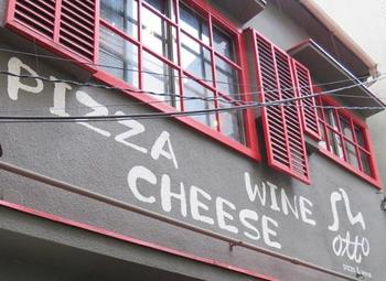
This shop is close  to Hatchobori 2-chome, Hatchobori Station, just off the alley from Shin-ohashi-dori St. to Hatchobori 2-chome, Hatchobori Station, just off the alley from Shin-ohashi-dori St.
The red sign and red door, red window frame, and inside of the store are cute shops that use red effectively.

I'm sorry  to bother you at lunch to bother you at lunch
The shop has the first and second floors, and since I was alone on the day, I sat down at the counter seats on the first floor.
I ordered a set A.
You can choose a drink or salad for the A set, and the B set has both a drink and a salad.
From 3 types of pasta, choose the bongole pasta of peeled clams.
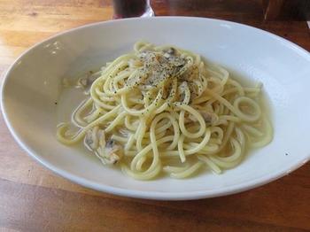
Raw pasta is thick, chewy, and smooth
The seasoning of Bongore, the flavor of garlic and black pepper is moderate, and there are quite a lot of clams, and it is very delicious.
After 12 o'clock, customers will come in one after another, so it is desirable to enter this shop as soon as possible.
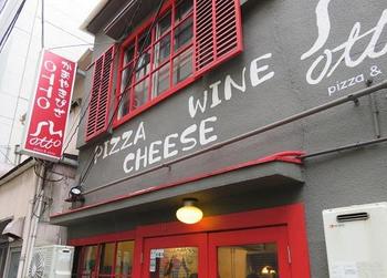
The shop says "pizza & wine, cheese", so I would like to  come next night and taste pizza, wine come next night and taste pizza, wine , and cheese. , and cheese.
The lunch time on weekdays is from 11:00 to 14:00, and the dinner time is from 17:00.
Regular holidays are Sunday and public holidays.
Click here for the OTTO website. ⇒
http://www.otto0731.com/
[Dimini ☆ Cricket]
October 14, 2018 12:00
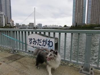
This is the second half of the blog that took a walk along the red dashed line river’s edge  on the map below with on the map below with  two dogs. two dogs.
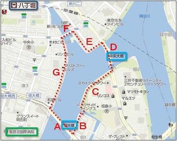
Area D
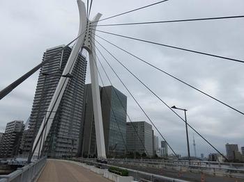
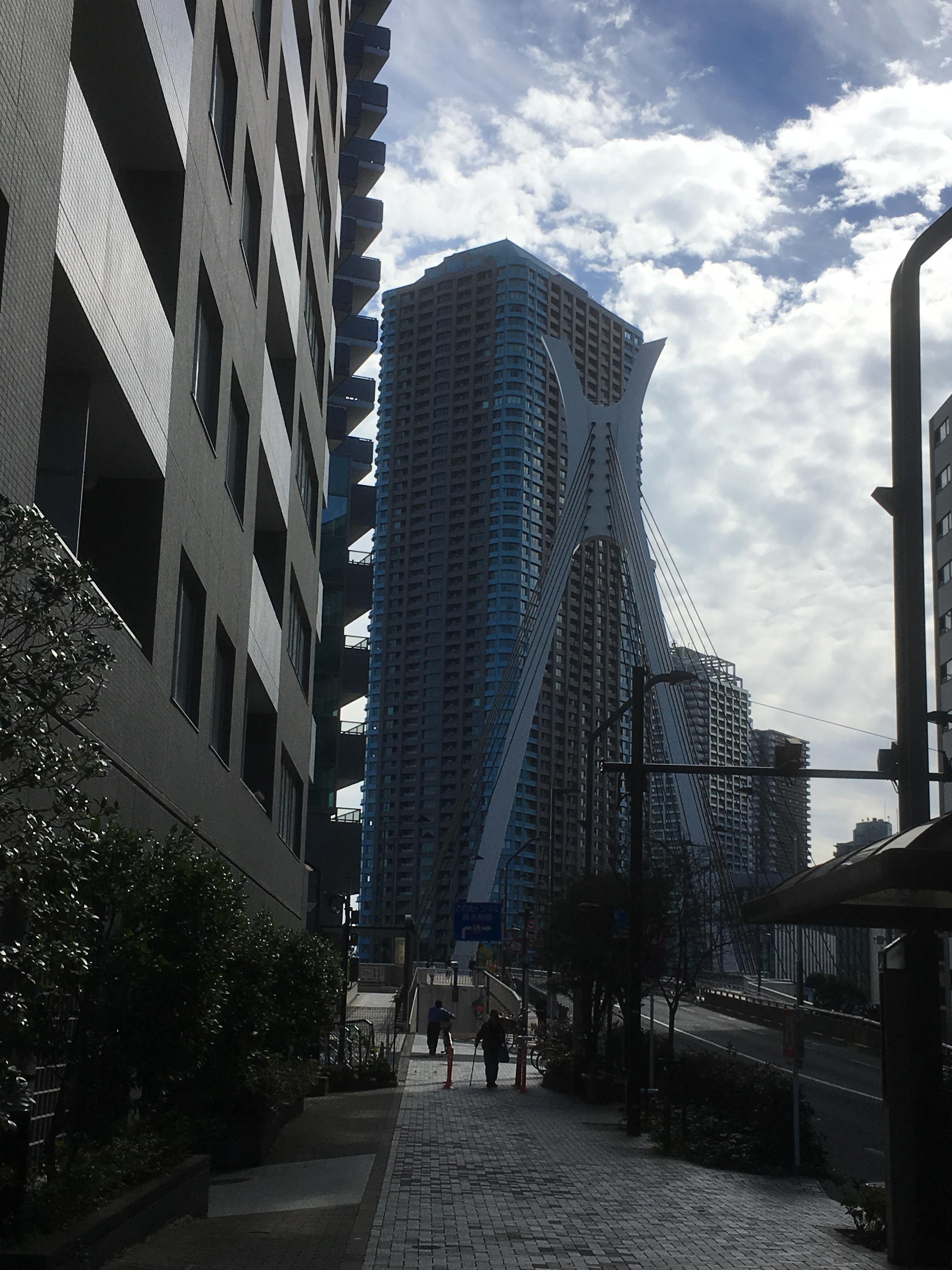
Chuo-ohashi Bridge  is a diagonal bridge that was built over the Sumida River in 1994. is a diagonal bridge that was built over the Sumida River in 1994.
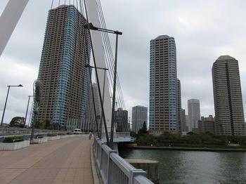
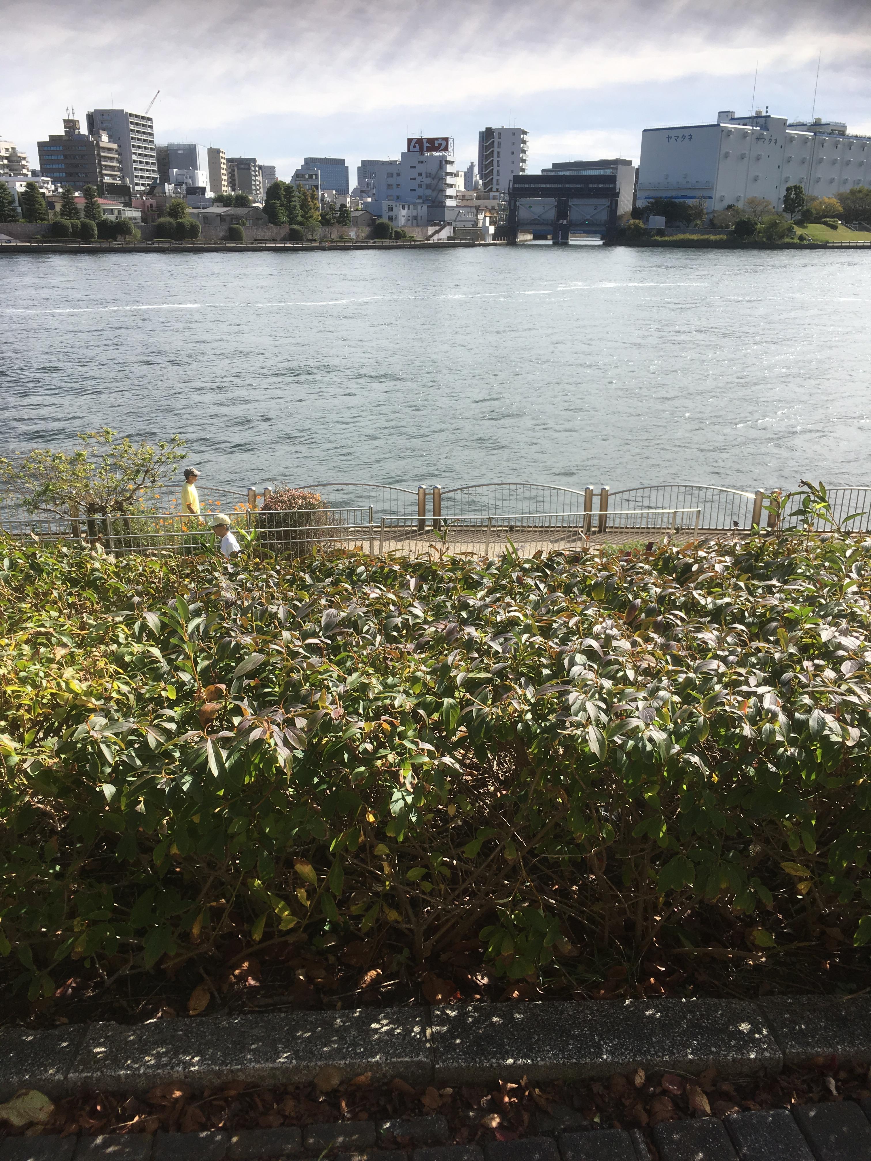
This photo shows the high-rise apartments in Tsukuda over Chuo-ohashi Bridge from the Shinkawa area side.
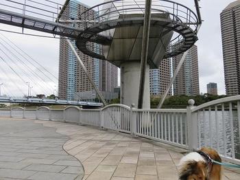
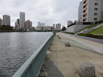
Area E
View Chuo-ohashi Bridge from river’s edge in the Shinkawa area.
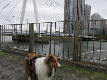
In 1873, it is the trace of the Reigishijima tide center installed in this area.
What appears behind the scenes is Tsukuda's high-rise apartment complex
Area F
Minami Takahashi is a bridge built over the Kamejima River in 1932.
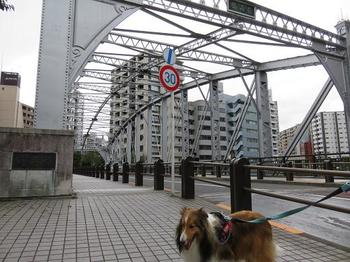
Through the earthquake disaster recovery project, the central part of the former Ryogoku Bridge has been relocated, reinforced and reused.
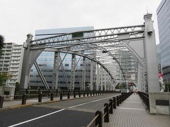
This is Minami Takahashi from the Minato area side.
Area G
It is a long and spacious Sumida River terrace in the Minato area.
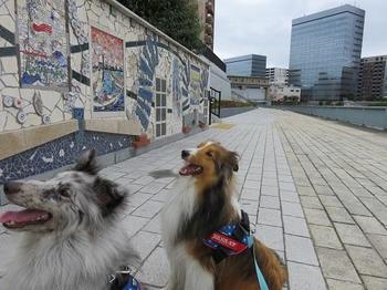
The walk in river’s edge feels good because of the wind.
By the way, the information on the history of this blog is based on the official text of the Chuo-ku Tourism Test, "Chuo-ku Monoshiri Encyclopedia", which was started on October 1 of this month. which was started on October 1 of this month.

|
Links
|