Chuo-ku Tourism Association Official Blog

Chuo-ku Tourism Association correspondent blog

Introducing Chuo-ku's seasonal information by sightseeing volunteer members who passed the Chuo-ku Tourism Association's Chuo-ku Tourism Certification and registered as correspondents.

List of Authors

>>About this blog

Recent blog post

Kayabacho Summer Festival! Sanno Festival resting place of portable shrines Festival

[Dharma] June 15, 2018 12:00

"Sanno Festival"...It is one of the three major festivals in Japan, along with the Gion Festival in Kyoto and the Tenjin Festival in Osaka. The 2018 event schedule is from June 7 to 17 (see the Sanno Festival official website!) 。 On June 8, the largest ceremony of the Sanno Festival, "Kamiko Festival", was held. 2 Goho, 1 Miya portable shrine, Shinto priesthood, Miko, shrine parishioner, Saru Tabiko, Carriage, gohei, Kasahoko float, Lion, Nobori, Higher Lantern...They traveled around the shrine parishioner area in a large line of 300m. It is a reproduction of the dynasty picture scroll. 7; 30 Head Office - 12:00 Imperial Palace Sakashitamon (Sanga) - 13:20 Hie-jinja Shrine Nihonbashi auxiliary shrine....In front of main hall, three Gohoren and Miya portable shrine were lined up, and the grounds were filled with no cones, including Shinto priesthood Ujiko, the press and visitors. A pilgrimage horse is taking a break on the sidewalk behind the auxiliary shrine...From here, Kyobashi-Ginza-Shimbashi-in front of the Prime Minister's Office-16:45 It will be a pilgrimage to return to Ee Shrine.

Kayabacho 2 Kamiyuki-240.jpgShinko Festival Kayabacho 1-240.jpg

auxiliary shrine 1-240 hydrangea 3.jpg5-240.jpg in auxiliary shrine

auxiliary shrine portable shrine 4-240.jpgHorse rest 6-240.jpg


Nihonbashi Takashimaya-Sanno Festival Shimomachi Union Hanoi-

[Tokyo Dumbo] June 5, 2018 18:00

In the lobby on the first floor of Nihonbashi Takashimaya, half-wearings of town associations and groups participating in the Sanno Festival's "Shitamachi Union imperial procession" are displayed.


IMG_3208.jpg


IMG_3217.jpg


IMG_3209.jpeg


From 9:00 to 14:00 on June 10, the Shimomachi Union imperial procession started at Hie-jinja Shrine auxiliary shrine in Kayabacho from 6 portable shrine, and after four joined at Hatchobori, 17 floats and portable shrine in Kyobashi, head to Nihonbashi on Chuoshima-dori.


Japanese lantern's preparations have progressed throughout the city, and the festival mood has increased.

Let's enjoy the main festival once every two years! !


IMG_3249.jpg


Walk along the ruins of Kaedegawa (2)

[Dimini ☆ Cricket] June 4, 2018 14:00

This is a continuation of "Walking the Ruins of Kaedegawa (1)"

kaede201800.jpg

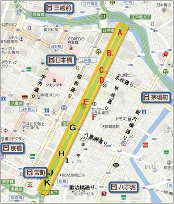
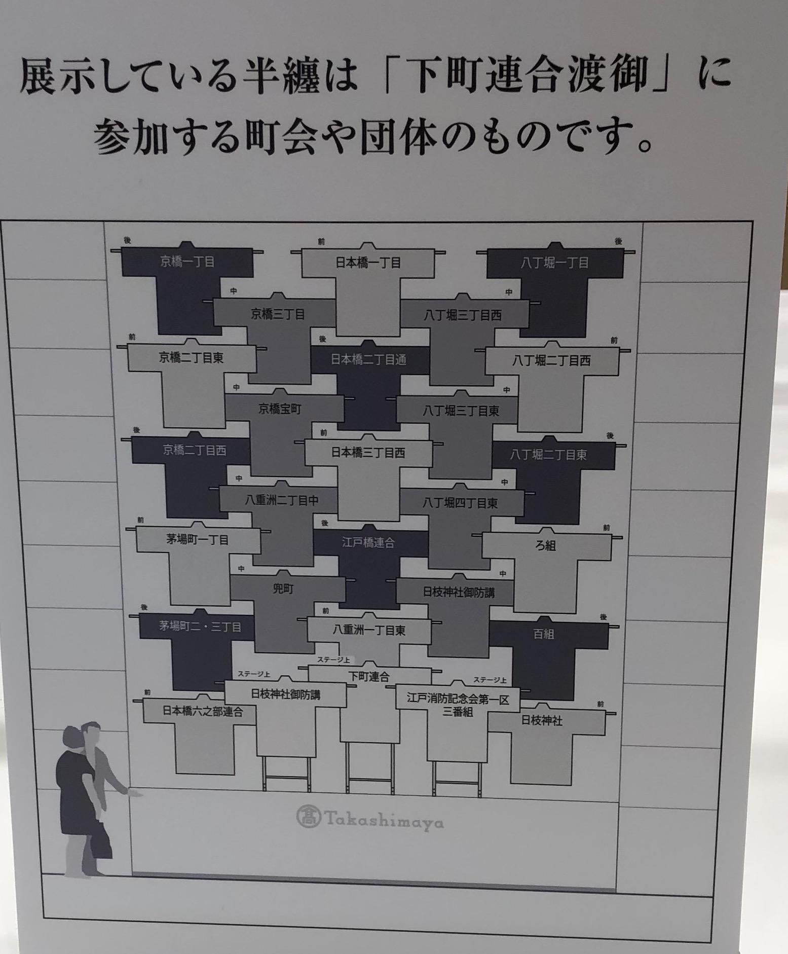
The Kaede River existed in Chuo-ku until the 1930s, diverted from the vicinity of Kabuto-cho on the Nihonbashi River to the south and reached the confluence of the Kyobashi River and Hatchobori (Sakuragawa). The Toshin Beltway, the Metropolitan Expressway, passes through the trace.

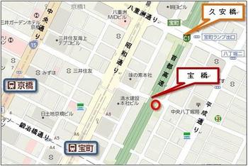
It is the yellow part of the map above.
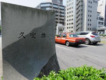
kaede201814.JPG

) It's Kuyasu Bridge.

This bridge is a bridge where Yaesu Street crosses the Metropolitan Expressway (formerly Kaedegawa).

The current bridge was rebuilt along with the construction of Yaesu Street by the reconstruction project of the Great Kanto Earthquake, and is a heavy arch bridge.

kaede201815.JPG

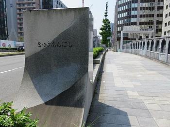
Kuyasu Bridge was built in front of the Kamiyashiki of Matsudaira-Etsunaka Mamoru in the Edo period and was called "Ecchu Bridge", but in 1868 the name "Ecchu", a remnant of Edo shogunate, was named "Kuyasu Bridge".

kaede201816.JPG

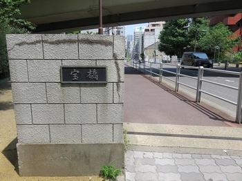
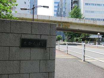
It's Takarabashi (H).

Takarabashi is a one-way narrow street connecting Kyobashi and Hatchobori, which crosses the Metropolitan Expressway (formerly Kaedegawa).

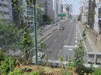
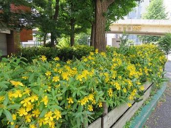
The photo below shows the expressway south of Hohashigami.

kaede201817.JPG

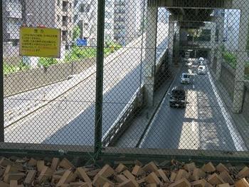
It seems that the name of Takarabashi comes from the town name "Takaramachi, Kyobashi-ku" on the Kaede Kawanishi side at that time.
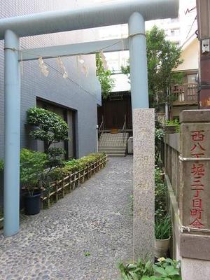
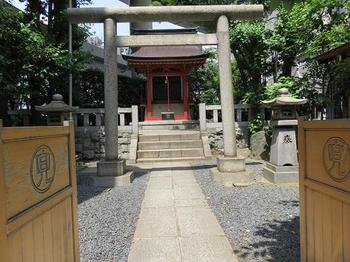
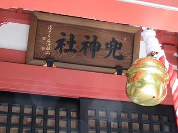
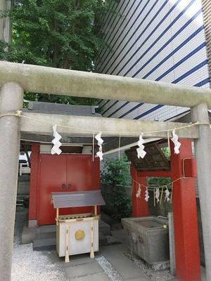
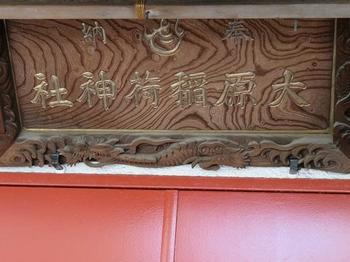
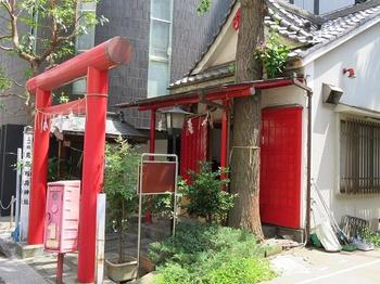
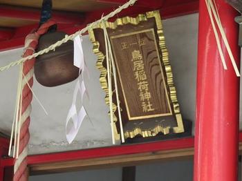
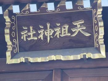
kaede201818.JPG

) At Tenso Shrine, a light blue torii gate, main hall is located right next to Takarabashi, along the narrow approach beside the building.

kaede201819.JPG

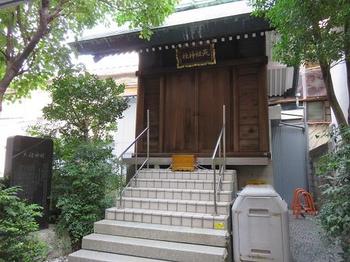
Although it is a small shrine, it has a history, and it begins in 1624 in the early Edo period when Ise Secretary-General Norimasa Ichinomasa served Izamiya, a separate shrine of Kotaijingu Shrine at Ise-jingu Shrine, at Edo Nihonbashi-dori 3-chome. It seems to be

kaede201820.JPG

In 1633, it was said that Hatchobori Matsuyamachi was relocated by the order of the Shogunate with a replacement area of 300 tsubo and a gate area.

kaede201821.JPG

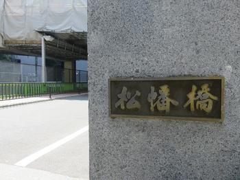
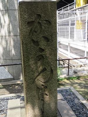
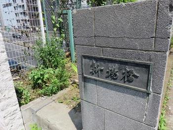
It's Matsuhatabashi (J).

It seems that it was named after taking one character of each town name from Matsuyamachi on the east side and Inabacho on the west side.

It was also called Matsuya Bridge in the Edo period.

kaede201822.JPG

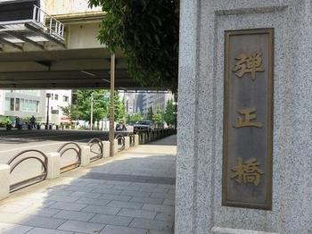
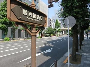
The bridge that spans the southernmost tip of Kaede River is Dansho Bridge (K) and Kaji Bridge Street.

Again, the current bridge was rebuilt by the Imperial Capital Reconstruction Project after the Great Kanto Earthquake.

In the early Edo period, there was a mansion of Tadatoshi Shimada Danjo on the east side, and it was called "Mitsuhashi" along with the Shiraoi Bridge on the Kyobashi River and the Shinpukuji Temple Bridge on the Sanjuma Horikawa.

In 1878, Japan's first () purely domestic iron bridge was built.

This iron bridge was relocated to Koto-ku in 1929 and was renamed Hachiman Bridge.

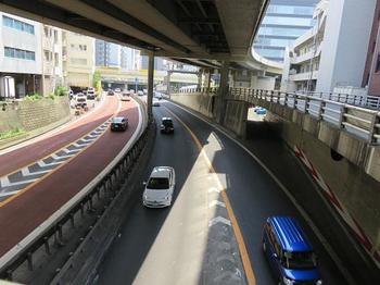
The photo below shows the highway on the south side from Dansho Bridge.

kaede201823.JPG

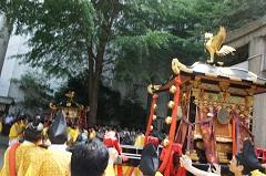
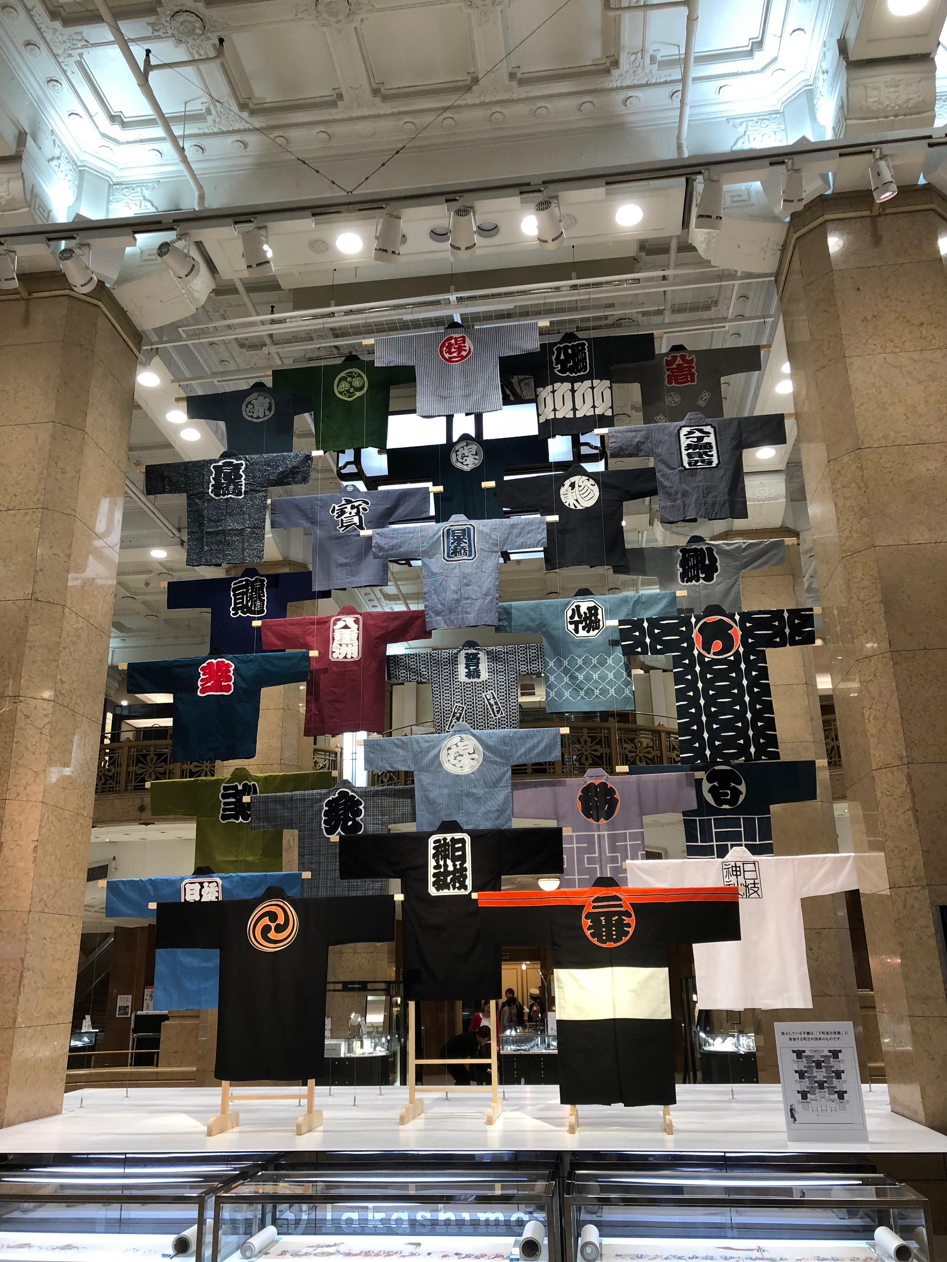
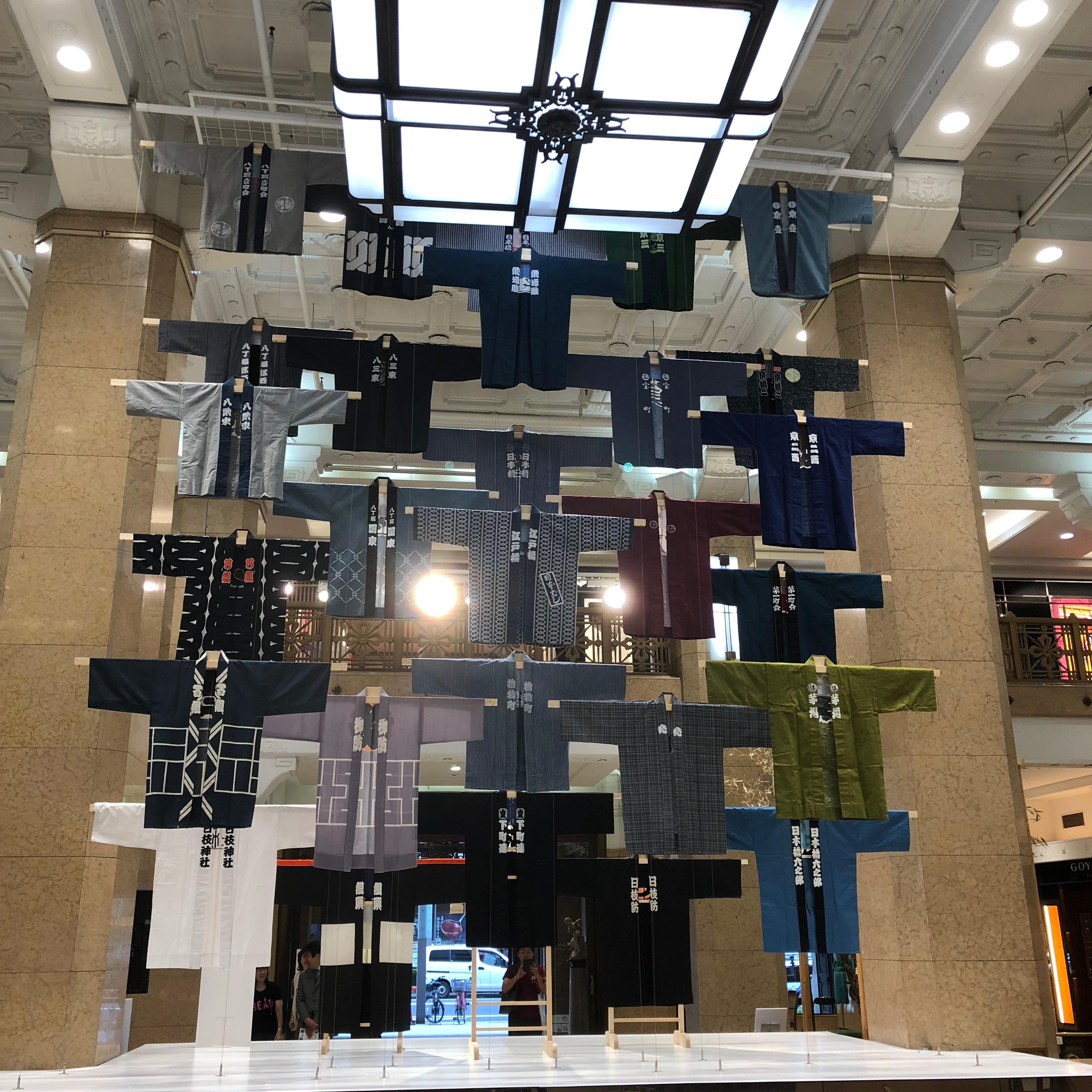
This time, when I walked along the Kaede River, it was a little short distance, but I was able to feel the weight of the history accumulated by "river and digging".

kaede201824.JPG

[Walking along the ruins of Kaedegawa] Complete


Walk along the ruins of Kaedegawa (1)

[Dimini ☆ Cricket] June 2, 2018 09:00

The other day (May 27), I read the "Edo Tokyo History Walk Following the "River and Digging" 20 Remains "" (written by Tetsushi Okamoto, PHP Shinsho) I was interested in Kaedegawa that once existed I walked along the former Kaedegawa river.

kaede201801.JPG

The Kaede River diverted from the vicinity of Kabuto-cho on the Nihonbashi River (currently near the Edobashi Junction) to the south, and was about 1.2 km from the confluence of the Kyobashi River and Hatchobori (Sakuragawa) (currently near the Kyobashi Junction). The Toshin Expressway was reclaimed from 1960 (Showa 35) to 1965 (Showa Expressway.

The yellow part in the map below is where Kaedegawa used to flow.

kaede201800.jpg

The starting point (A) was where Kabutobashi used to be.

The photo below shows a view of the place where Kabutobashi would have been built in front of Kabuto Shrine.

kaede201804.JPG

It's Kabuto Shrine.

kaede201802.JPG

In the precincts, there is Kabutoiwa, which is said to have been reported to have stopped by Yoshiie Minamotono and prayed for victory in the role of the previous nine years.

This was the origin of the name of Kabuto-cho.

kaede201803.JPG

) This is where the shipping bridge was built.

kaede201805.JPG

It was said that it was called Takahashi in the early Edo period, and later the Pirate Bridge and Shogen Bridge.

In the first year of the Meiji era (1868), it was renamed the Shipping Bridge over "Good luck".

Currently, only two main pillars are left.

kaede201807.JPG

Chiyodabashi (C) is a bridge built by Eitai-dori St. across the Kaede River.

kaede201808.JPG

Ohara Inari Shrine (D) is enshrined on the south side of Chiyodabashi, just a short walk away, with a highway behind it.

kaede201809.JPG

It's Shinba Bridge (E).

kaede201810.JPG

It is said that Nakanohashi and Kaedebashi were also nicknamed. In 1674, a new appetizer field (Shinkasaba shore) was set up on the west side as the second fish shore following the Nihonbashi fish shore, and it was abbreviated as Shinba It seems that it was

kaede201811.JPG

If you look at the expressway north of Hashigami of Shinbabashi, you can clearly see that the road is coming down from the elevated to the bottom of the Kaede River.

kaede201812.JPG

Torii Inari Shrine (F) is located just next to Shinbabashi, just a little from Sakura-dori St.

kaede201813.JPG

It stands in a quiet place, and the word "No. 1" is impressive.

[Continue on the site of Kaedegawa (2). ]


Aweed willow at the base of the treasure bridge

[Dimini ☆ Cricket] June 1, 2018 09:00

Takarabashi is a bridge that spans the former Kaede River, which has already been reclaimed, but now the Metropolitan Expressway Toshin Beltway runs below.

takara201801.JPG

Although the traffic volume of Takarabashi is not large, there are highways running not only under the bridge but also above it.

takara201802.JPG

Willows are blooming all over the planting space at the base of Hatchobori side of this treasure bridge.

It's the place in red on the map below.

takara201800.jpg

Byou willow (Mioyanagi, Beauty willow) is a semi-deciduous shrub of the family Asteraceae.

takara201803.JPG

It is native to China and came to Japan about 300 years ago. The flowering season is around May to July, and blooms five yellow petals with a diameter of about 5 cm.

takara201804.JPG

Kinshibai, which blooms yellow flowers at the same time, is also a member of the same family, and it is very similar when viewed from a distance, and it is not possible to distinguish between the flowers, but if you look closely at the flowers themselves, the willow oshibe is long and It stands out well.

takara201806.jpg

The photo above is Kinshibai, and the photo below is Biyo willow.

takara201805.jpg

Click here for a blog about St. Luke Street's Kinshibai and Byouwillow willow last June. ⇒

/archive/2017/06/post-4378.html


1