List of Authors
>>About this blog
Recent blog posts
|
[CAM]
20:00 on October 31, 2015
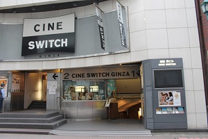
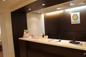
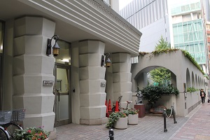
[6] "Ginza Jujiya Harp & Flute Salon hanare", where the "Harp Mini Concert" is held, is on the 5th floor of the building with the movie theater Sine Switch in Ginza 4-4-5. The entrance is a bit difficult to understand, but if you enter a little on the left side of the movie theater, there is an elevator entrance.
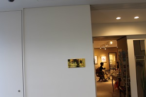
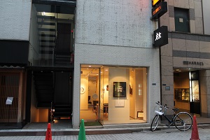
This is an art gallery where "7" and "Aftanoon Gallerys" are opened.
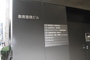
"Ginza Yanagi Gallery" Ginza 5-1-7 Sukiyabashi Building 3F. It's right behind Yasuaki Elementary School.
Yasuaki Elementary School is also the "Information & Lottery Venue" and the venue for "5" and "Ginza Shogi Festival".
It is "Yasushiyama Gallery" (Ginza 5-14-16, Ginza Abitacion 1F). It is a short walk through the other side passage across Harumi-dori St. in front of Kabukiza.
"Gallery Hayashi" (Ginza 7-7-16) is located just a little on the left street towards the front of Hanatsubaki-dori Street and Tsubakiya Coffee Shop.
[CAM]
18:00 on October 31, 2015
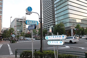
From the Irifunebashi intersection, proceed further to "Shin-ohashi-dori St.". You can see the entrance to Tsukiji Station subway.

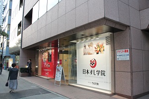
Furthermore, if you follow Shin-ohashi-dori St., you will find Nihon Sushi Gakuin on the right.
As you go further, you will see the distinctive "Tsukiji Honganji" tower.

Turn left here, and near this intersection is Kyobashi Tsukiji Elementary School. The integration of Kyobashi Elementary School and Tsukiji Elementary School was in 1992. According to the "Population Change in Chuo-ku" on page 85 of Monoshiri Encyclopedia, the population was the lowest in April 1997, with 71,806, but in April 2006 It seems that it recovered 100,000 for the first time in 31 years, and in January 2014, it seems that it has recovered to 140,000 for the first time in 51 years. If the school age population increases, will the elementary school be re-divided again? ? ?

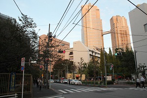
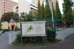
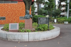
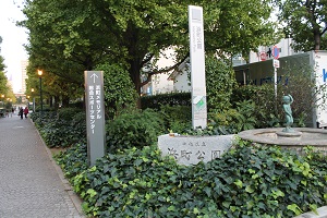
Turn left at the intersection near Kyobashi Tsukiji Elementary School, turn left at the end, and you will see St. Luke's Tower in front of you, but on the right you will see the entrance of Akatsuki Park. In this "Akatsuki Park", there is a bust of Siebold (Monoshiri Encyclopedia; page 72).
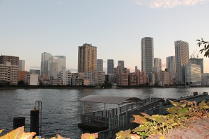
From the nearby Akashicho Riverside Park, take the Akashicho Disaster Prevention Fleet in front of the Tsukishima / Kachidoki area.
[CAM]
14:00 on October 31, 2015
Today (October 27, 2015) departs from Kayaba Bridge. (All photos taken on October 27, 2015)
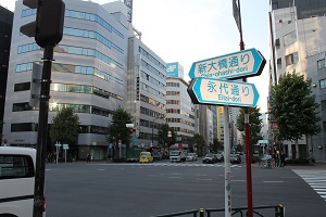
A short walk from Kayaba Bridge, the intersection with Eitai-dori St. You can also see "COREDO Nihonbashi" on the right.
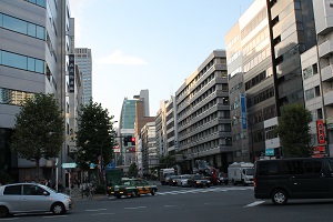
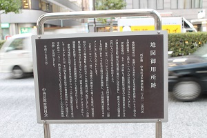
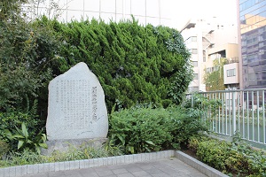
As you go further on Shin-ohashi-dori St., you will also find an explanation version of "Map Goyosho Ruins" on the left walking path (near 2-12 Nihonbashi Kayabacho).
The "Map Goyosho" was located in the residence of Tadataka Ino (1745-1818), known for producing the first full map of Japan based on actual measurements.
Tadataka Ino began surveying all over Japan in 1800 (1800), surveying the coasts of Japan for the next 17 years, and it is said that the total distance was about 40,000 km.
In 1814 (1814), Tadataka returned from surveying in the Kyushu region and moved to the vicinity of the current location, which was called Hatchobori Kamejima-cho. The site of this mansion was about 150 tsubo, but it was used not only as a place of residence for loyalty but also as a map gosho for creating survey maps.
Tadataka died in his home in Kamejima-cho in 1818 (1818) before the map was completed, but Tadataka's home was still used as a map gosho, and in 1821 (1821) The "Dainihonenkai Yochizenzu" was completed by the hands of the masters.
Continue further to the intersection with Yaesu Street.
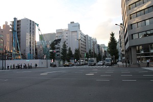
On the left side of this intersection is Kameshima Bridge, where there is also the "Horibe Yasubei Takeyuki Monument" (Monoshiri Encyclopedia; page 55). Under Kameshima Bridge, the Kamejima River still remains, and it is one of the few active bridges that were replaced in 2002 (Monoshiri Encyclopedia; page 56). High-rise apartments in River City 21 can also be seen from a distance.
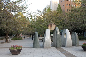
If you follow Shin-ohashi-dori St., you will see the entrance to Sakuragawa Park on the left. Horiwari, which was called Hatchobori in the Edo period, was renamed Sakuragawa in the Meiji era. Sakuragawa Park was created using a part of the site that was reclaimed in the middle of the Showa era.
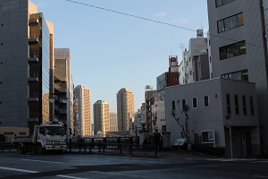
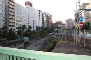
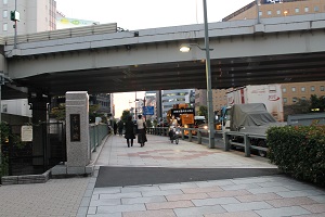
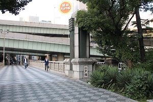
 From Irifune Bridge, when you look at Chuo-ku government office, Ginza Blossom, etc., it is clear that below was a river. From Irifune Bridge, when you look at Chuo-ku government office, Ginza Blossom, etc., it is clear that below was a river.
[CAM]
12:00 on October 31, 2015
Right after passing Nihonbashi Junior High School, there is a street to Yagenbori Fudoin (Monoshiri Encyclopedia; page 97). (All photos below are taken on October 26, 2015)
 Next, we will enter Kiyosumi-dori St. Next, we will enter Kiyosumi-dori St.
 If you follow Kiyosumi-dori St., you will see Meijiza on the left. If you follow Kiyosumi-dori St., you will see Meijiza on the left.

On the right side of Meijiza, you can see the entrance to Hamacho Park.
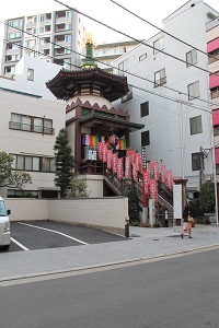
A little further away, you can see the temporary palace of Suitengu.

If you go a little further, you will reach the intersection with Shin-ohashi-dori St. The number of high-rise apartments has also increased in this area.
If you follow Shin-ohashi-dori St., you will see Hamacho Green Road on the right side. There are also statues of Benkei in the Kanjin Book and display boards for "Ningyocho Hamacho Walk".

This Hamacho Green Road is the site of the Hamacho River. The Hamacho River was once a waterway that splits from the Kanda River on the banks of the Kanda Sakuma River in Chiyoda-ku, and merges with the Sumida River near the downstream of Kiyosu Bridge. It is an artificial waterway excavated during the Edo period. Since then, excavation has been repeated for a long time, and it has been very useful for people's lives, but in the Showa era, landfills have begun as a place for disposal of residual soil after the war. Furthermore, by the end of the 1940s, the Tokyo Olympics, the arrival of the period of rapid economic growth, and urban development, all the rest were reclaimed. At present, buildings, roads, private houses, green spaces, etc. are formed on top of the Hamacho River, and Hamacho Green Road is a part of it.
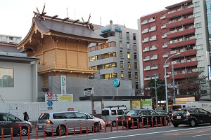
As you go further, you will again reach the intersection with Ningyocho-dori St., and you will see Mizutengu under rebuilding. It is scheduled to be completed in the spring of 2016 (Honshiri Encyclopedia; 100 pages).
We go further to the Nihonbashi River and cross the Kayaba Bridge. Kayaba Bridge is the third bridge from the lower part of the Nihonbashi River. Toshin Beltway runs over the sky. Minato Bridge is located downstream of the bridge, and Armor Bridge is located upstream. The current bridge was replaced in 1992 due to the aging of the old bridge (Honshiri Encyclopedia; page 25).
[CAM]
09:00 on October 31, 2015
Today, we start from Edobashi (both of the following photos were taken on October 26, 2015).
Turn right across Edobashi toward Ueno and cross the intersection with Ningyocho-dori St..
As you proceed, you will see the Hisamatsu Police Station on the left.
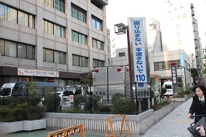
On the back side of Hisamatsu Police Station is Hisamatsu Elementary School.

On the right side of the street, you can see Kasama Inari Shrine Tokyo Betsusha (Monoshiri Encyclopedia: page 101).
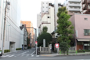
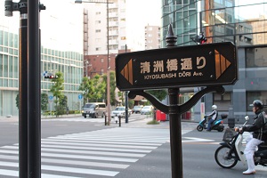
This is the intersection with Kiyosubashi-dori St.
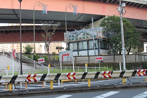
If you proceed as it is, you will reach the Sumida River shore and see the water bus departure and arrival point.
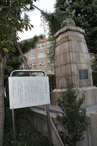
Turn left on the road and follow Hamacho Riverside Street. On the left, you will see the memorial monument of former Chiyoda Hirone Elementary School.
 Turn left just before Ryogoku Bridge and Yasukuni Dori and follow Miyuki Street, you will see the front entrance of Nihonbashi Junior High School on the left. Turn left just before Ryogoku Bridge and Yasukuni Dori and follow Miyuki Street, you will see the front entrance of Nihonbashi Junior High School on the left.

[CAM]
18:00 on October 30, 2015
Turn left at Sukiyabashi intersection and enter Sotobori-dori St., and you will see "Nichido Gallery" right on the left side of the street.
![IMG_1965[1]. jpg](https://en.tokuhain.chuo-kanko.or.jp/archive/IMG_1965%5B1%5D.jpg)
Sotobori-dori St. intersects Miyuki Street at Ginza 5-chome and Kojunsha Street at Ginza 6-chome. The street is lined with boutiques, cafes, jewelry stores, and ateliers. In addition, it crosses Hanatsubaki Street at Ginza 7-chome. There is a Nishi Ginza parking lot in the basement of Ginza 5-chome to 8-chome on Sotobori-dori St., and there is an entrance to the parking lot along the street.
Continue as it is, and from Ginza 8-chome, there is the Tsuchihashi intersection where Sotobori-dori St. and Gomon Street intersect. Located at the southernmost tip of Sotobori-dori St. Chuo-ku, there is the Dobashi Interchange of Tokyo Kosoku Doro.
![IMG_1969[1]. jpg](https://en.tokuhain.chuo-kanko.or.jp/archive/IMG_1969%5B1%5D.jpg)
The bus on the day will pass through Tokyo Kosoku Doro, turn left at Sotobori-dori St., and enter Showa-dori.
Here, you will turn left on the highway and proceed along the gate street. On the left is Shibakuchi Monzeki.
![IMG_1971[1]. jpg](https://en.tokuhain.chuo-kanko.or.jp/archive/IMG_1971%5B1%5D.jpg) Then, turn left at the end of Mitsui Garden Hotel Ginza (pictured) and enter Showa-dori. Then, turn left at the end of Mitsui Garden Hotel Ginza (pictured) and enter Showa-dori.
(I'll go back to the bus route from here.)
![IMG_1972[1]. jpg](https://en.tokuhain.chuo-kanko.or.jp/archive/IMG_1972%5B1%5D.jpg)
It crosses Hanatsubaki-dori Street around Ginza 7-chome, but the pedestrian bridge has an escalator.
![IMG_1974[1]. jpg](https://en.tokuhain.chuo-kanko.or.jp/archive/IMG_1974%5B1%5D.jpg) You can see the tower on the roof of the building for power development. You can see the tower on the roof of the building for power development.
![IMG_1975[1]. jpg](https://en.tokuhain.chuo-kanko.or.jp/archive/IMG_1975%5B1%5D.jpg)
Again, pass through the Mihara Bridge intersection and go straight on Showa-dori in the direction of Nihonbashi.
![IMG_1977[1]. jpg](https://en.tokuhain.chuo-kanko.or.jp/archive/IMG_1977%5B1%5D.jpg) The entrance to the Kabukiza building on the right side of Showa-dori. The entrance to the Kabukiza building on the right side of Showa-dori.
![IMG_1978[1]. jpg](https://en.tokuhain.chuo-kanko.or.jp/archive/IMG_1978%5B1%5D.jpg)
Ginza 1-chome to 4-chome along Showa-dori. The office building is lined up, but the first floor is like Ginza, and show windows such as crystal products, shoes, and painting galleries are lined up. On the other hand, if you enter the one side road, there are places where old buildings can look into their faces.
An intersection with Kajibashi-dori Street, where the exit of Takaracho Station on the Toei Asakusa Line surrounds all sides. As with other intersections, many cars and people come and go. The area around this area is now Kyobashi, but it was newly named Takaramachi in 1931 after the reconstruction of the earthquake. The name is left in the name of the Toei Subway station.
![IMG_1980[1]. jpg](https://en.tokuhain.chuo-kanko.or.jp/archive/IMG_1980%5B1%5D.jpg)
When you pass through Kyobashi 1-chome to 3-chome, Showa-dori crosses Yaesu-dori.
![IMG_1985[1]. jpg](https://en.tokuhain.chuo-kanko.or.jp/archive/IMG_1985%5B1%5D.jpg)
Edobashi 1-chome intersection where Showa-dori Street and Eitai-dori St. intersect. A car heading to Uchibori-dori St. in the direction of the Imperial Palace or a car entering Showa-dori Street is characterized by a particularly large amount of traffic on Showa-dori Street. From the vicinity of the intersection, you can see the appearance of Coredo Nihonbashi first.
![IMG_1986[1]. jpg](https://en.tokuhain.chuo-kanko.or.jp/archive/IMG_1986%5B1%5D.jpg)
Coredo Nihonbashi.
![IMG_1989[1]. jpg](https://en.tokuhain.chuo-kanko.or.jp/archive/IMG_1989%5B1%5D.jpg)
This is Nihonbashi seen from Edo Hashigami.
![IMG_1994[1]. jpg](https://en.tokuhain.chuo-kanko.or.jp/archive/IMG_1994%5B1%5D.jpg)
|
Links
|

